

Apglos Survey Wizard - easiest land survey app
Apglos Survey Wizard can be connected to a GNSS receiver. In this way land surveying can be done with cm accuracy. This field data collection app works with almost any GNSS antenna.
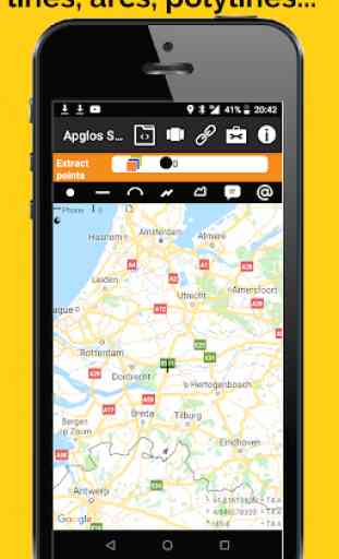
This land survey app is great for exporting points from the field or for field data collection. This app makes you able to land survey points, lines, arcs, polylines and areas. Besides that you can add comments and symbols to the drawing. It is ideal for land surveying of civil engineering works, mining or construction.
Apglos Survey Wizard uses layers like AutoCAD. All layes have colors, line styles and line weights. You can change them in the same way as in AutoCAD.
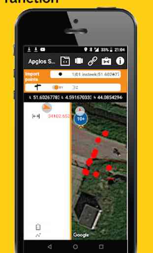
Also staking out or importing points into the field is included in this land survey app. Select a point on the Google map and you will see the direction and the distance to this point right away. You don't have to worry about how you hold the device where this GPS app is installed on. Apglos Survey Wizard keeps notice of this and changes the given direction. You only have to follow the arrow.
Small drafting work can also be done in this land survey app for GPS. Elements can be offsetted, extended or shortened. But also points can be added manually by filling the coordinates. Points can be connected. In this way lines, arcs, polylines and areas can be drawn. It is very easy.
Another great function is the calculation method. With Apglos Survey Wizard you can calculate areas, lengths and distances. Also height difference and element count are very popular functions.
This land survey app can also be used as a GIS app. It has full GIS functionality. Elements can be added and deleted. Also attributes can be added and changed. Also photos can be made of elements. For using the GIS functionality you don't need a GNSS receiver. Then this app works on the GPS of the device, like a telephone or a tablet.
A GNSS receiver is only necessary when you want to land survey with cm accuracy. Apglos Survey Wizard has some security built in that no values can be surveyed when there is no RTK correction. Non accurate values won't be collected. It will give you a warning. Also a warning is given when you want to stake out points. The distance will be marked red. Then you know that the distance given is not that accurate.
As you can see this is a very complete land survey app for GPS. Apglos Survey Wizard can open en save data in the following formats:
-dxf
-txt
-csv
-kml
-agl
-agp
-shp
-xyz
It can also save data in landxml file format.
This app can do a lot, but the main thing is that it is very easy to use. Anyone can use this land survey app.
Category : Productivity
Reviews (30)
I wanted to test a simple task....type in latitude and longitude and have it take to the point for a stakeout. No way to do it. The manual is just screen descriptions. No use for real surveys. As best as I can figure out, the "stakeout" option takes you to points that are simply picked on a map with a finger. Very disappointing, especially since it says it's the best and easiest.
Very significance easier way for collecting sketches mapping
I have no experience with survey software. I have tried other apps and they are confusing. With no experience and about 45 minutes I was able to map out a 40 acre land parcel with key points, and distances. Great app!
Hey this is a great app. I had a few problems setting up the reciever and I was able to easily communicate with the developer. These guys have there own YouTube channel to go along with the app. Basically my logger broke and this app replaced it. You don't need an expense logger. Use your android phone! HAPPY DAYS. Craig Sibthorpe. 30+ years in the Civil Engineering marke in Europe..
I just got a walkthrough on the app , so far I love about on its interfaces and colors , I havent try to connect on my GNSS reciever but i think I will work. But , Im confused regarding on a coins stuff. What does it mean?
Ok walking round a space clicking buttons and getting an image on screen but hopeless at storing, reviewing or exporting a file.
Does not give ability to use camera to pinpoint. If it does, it's not easily found....
After the last update it will not import csv or dxf files. It just says "The given file name is incorrect" whenever trying to import these file types
A very easy to use app. Really helpfull and also to mention the immediate reply to any questions you might have!
You have to register first to be ablr to use it. You cant even try without free email registration.
I have downloaded buthavent try in real work...i keep looking at these screen what those icons are...
nice and easy to connect to f9p...good to go for survey
Stake or and survey work great with an external GNSS RTK receiver.
Cool app, learning to use it! I'll come back later with a full review
I've been a land surveyor for 15+ years. This app is insulting. It's less than garbage
Easy to use app. Did exactly what it needed to do.
Many things to learn before you can actually use this app. And that is exact what I like about it!
Good surveying app and easy to use
I am new to GPS surveying and still trying to learn the fundamentald
Very helpful in the field
Seems to be what I need still trying to figure it out
good apps.. easy to use.
Tells me to log in again if I press any buttons.
Fantastic service from a company that cares about their clients needs
This the first time I am going to use this app hope it will be of good benefit to me.
Good application for surveyor
Once I figured it out, it's a great app!
Free coins with good review
Interesting, seems cool
UPADTED REVIEW 13/01/2022: After fiddling with the settings and trying out a bunch of combinations I got a CSV file output with all the data accurately represented. I now rate the app 4 stars, it provides great data in any format you could possibly want. Only small niggle is the UI is a bit cumbersome but once you're used to it its perfectly useable. For reference my old review is down below. OLD REVIEW: I wanted to be able to plot points on a map accurately and output them to a CSV file accurately. Unfortunately, when exporting to a CSV file the app only writes to three decimal places, what use is that when dealing with lat long data?