Canada Topo Maps Free
**
* Attention: Please use Toporama or Canada Base Map layer if you need most recent topo maps ! ***
Main features for outdoor-navigation:
• Bulk-download of map tiles for OFFLINE USAGE (NOT in this FREE version)
• Create and edit Waypoints
• GoTo-Waypoint-Navigation
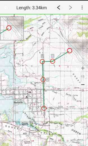
• Create and edit Routes
• Route-Navigation (NOT in this FREE version)
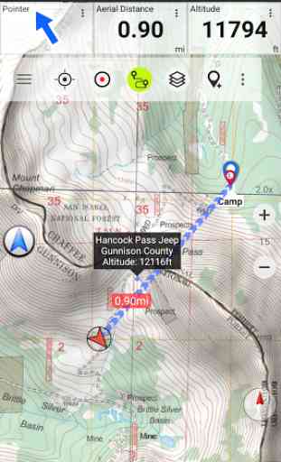
• Track Recording (with speed, elevation and accuracy profile)
• Tripmaster with fields for odometer, average speed, bearing, elevation, etc.
• GPX-Import / Export, KML-Export
• Search (placenames, POIs, streets)
• Customizable datafields in Map View and Tripmaster (e.g. Speed, Distance, Compass, ...)
• Share Waypoints, Tracks or Routes (via eMail, Facebook, ..)
• Use Coordinates in UTM, WGS84 or MGRS
• and many more ...
Available map layers:
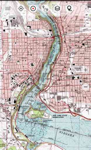
• Topomaps Canada (CanMatrix, seamless coverage at scales 1:50.000 and 1:250.000)
• Toporama Maps Canada in EN&FR (CanVec, NTDB, Atlas of Canada)
• Canada Basemap (CanVec, NTDB, Atlas of Canada)
• CanTopo (new Canada topos at 1:50.000, partial coverage of Can)
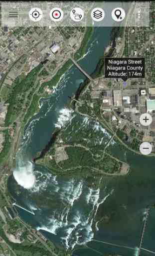
• Google Maps (Satellite images, Road
- and Terrain-Map)
• Bing Maps (Satellite images, Road-Map)
• Open Street Maps (OSM Mapnik and Cloudemade Cyclemap)
• Hillshading overlay layer (NOT in this FREE version)
Toporama Maps Canada: These are the most recent topographic maps of Canada.
Topomaps Canada: These maps contain many small pathes and 4WD tracks that are missing in Toporama, Google, Bing and OSM maps. This layer is essential for real outdoor and offroad trips in Canada. Seamless mosaic of more than 13.000 collar clipped 1:50.000 maps.
LIMITATIONS OF THE FREE VERSION:
• Ads
• No Bulkdownload
• No Hillshading overlay
• Max. 3 Waypoints
• Max. 3 Tracks
• No Routes
• No import of waypoints and tracks
• No Local City DB (Offline Search)
Use this navigation app for outdoor activities like hiking, biking, camping, climbing, riding, skiing, canoeing or offroad 4WD tours.Preload FREE map data for areas without cell service.
Canadian topographic maps are enhanced with Atlogis® hillshading and placenames.Credits for topographic map data: "© Department of Natural Resources Canada. All rights reserved."
Please send comments and feature requests to [email protected]
Category : Maps & Navigation
Reviews (24)
Worked well for perhaps a year, then suddenly, would not load any of the offline maps although they were still in the default directory. Re-installed the program, and that did not seem to help. The user interface and menu options are woefully lacking in intuition and available options. Although its simplicity was the original attraction for me, the functionality turned out to be a disappointment.
Some unfair reviews. First, free version allows search by address. Second, you are cautioned that not all maps are current and to verify using other map layers. In my undergrad (geography) I would've been over the moon with this app. No having to trek around paper Geological Survey maps (I still have a few that I pull out because Google Maps sometimes lacks key details). A GPS read out that is (vs mid 90's) military grade and isn't the size & weight of a 4 L bag of milk! Etc. Check it out.
Initial impression excellent! Lots of features in free version — I don't know what the cranks have going on in their heads. 😜😁 Yes, long list of maps to choose from and quality varies considerably. Be grateful and disable the ones you won't use at all. Some minor features mislabeled on some maps — not the app developer's fault. OpenStreet, OpenTopo and the ESRI selections are my faves for now.
I don't see trails on this app. The contours are great but for someone like me who is mostly on trails, I would like to see the route options. Or am I missing something? Also, sometimes it just greys out and the map becomes invisible. And all the layer options are confusing. Simple please! I doubt I will renew my subscription.
I do a lot of walking out in the woods and this app is a must if going anywhere out of the treaded paths. The pro version is certainly worth the cheddar, especially if you consider the price of a Garmin. There are many different kinds of maps, overlays and some are worldwide. This app makes it easier to take into consideration the various waterways if you're going on a canoe trip. The topographic maps are rich and there are a few just to compare them. Download these maps offline and you're set
Basically as accurate as Strava. And it's map based! Unlike Strava. This app is also more accurate over muddy swamps and creeks than Gaia GPS. One thing I really think could improve your app would be upgrading the zoom features to like that of Google maps. Mostly I got this application because of the free topo maps that you can select from.
Unfortunately I have to uninstall this app since I got my new phone (Google pixel 4a 5g with android 11). I've been unable to open any files from any app, but most noticeably outlook, because for some reason they are trying to open with this app by default and I can't change it. In settings, there's nothing that says this app should open my files. Kind of concerning tbh. As an example, I try to open a Google word document, Canada maps tries to open it, but fails because it's a word doc
I installed the app and accepted the EULA and then it said, "Unfortunately Canada Maps has stopped.". I tried uninstalling and reinstalling with the same result. So it didn't work at all. Thanks for your response.. Yes, I did click send report when it crashed. I will email support later as per your suggestion.
Back Roads Bill...this app has all the foundations and is easy to use and understand the relationship between the digital map. The compass and the GPS service.
This such an amazing map app. I usually don't buy the pro version of things too because they are membership based, but this one is reasonably priced and a one time payment.
I was stupid enough to purchase the pro version. I thought just maybe it would work better than the free version wrong. I bought it to use the topo maps useless I have had it for a day cannot get a usable area of a map to load. Beware not worth the money if it were free.
Awesome app. Packed with features which felt overwhelming at first, but quickly and easily revealed themselves through fun exploration. Lots of tip dialogues in the beginning and tutorial info is articulate and helpful. For sure the best out there.
Perfect app for any outdoorsy individual! I've used many but this app beats all. Very detailed, accurate, functional and easy to use. Free version is all I need but given how good it is I wouldn't mind paying few bucks for it :)
Good idea, the only problem I am having is EXTREMELY slow map rendering. I wanted to purchase the pro versiin but this is what throws me off. It seems to have worjed better in the past. I am using rather fast device - Huawei mate 20 pro - and waiting minutes for maps to show up is unacceptable.
Looks like a good app, but without being able to download maps for offline use on the free version, it is hard to test it before committing to a purchase. Maybe a 2 week free trial would be nice.
Paid for the updated version and it saved us from spending the night on the trails. 106 kms put on, a broken down sled, and about 3 hrs behind schedule we arrived back at our vehicles before our families called out the search party. All thanks to this app!
Roughly ten seconds after opening this app, I discovered that (at least in the central Alberta portion) it is at least two decades out of date. If it's that out of date in areas in know, how can I trust it in areas I don't? If that's because I'm using the free version, then shame on you for purposely endangering people for money.
Garbage app, can't even type in the address because it says it is not available in the free mode, need to purchase the pro mode of this app in order to utilize this app in full mode to type in addresses to know where you are going. so it's being deleted garbage app don't even bother uploading it people.
good site for navigating bush. used it for some pre hunting in a new area. could be a little more user friendly. overall a good tool for navigating new areas.
I find this very useful to trace canoe routes. It is especially useful during this pandemic because I can't actually get out there.
Does what I want, simply but has lots of features that may be useful to others. I like the map layers.
I was looking for a digitized topo map for my bush hiking. This app provides useful and relevant features to accompany me.
Map choices including satellite make this my go to maps/satellite imagery for my hunting trips. You cant beat the detail in the ESRi aerial.
I was looking for something to measure point to point distance since Google Maps doesn't, and I can't get Foreflight on an Android device. Got exactly what I needed within 30 seconds of opening it. The 1:50000 scale is the same that I use for air SAR as well, so it should be very useful. I will definitely consider buying pro if I start using it more.