
FOJ OHV Map
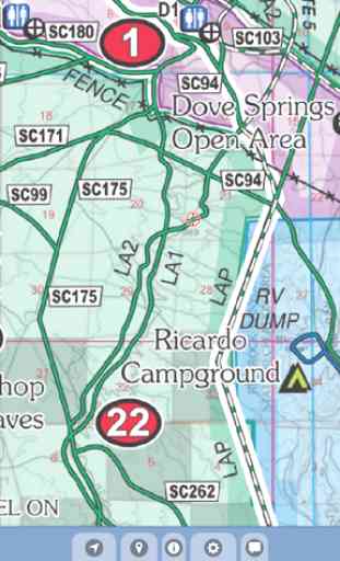
View the map in several zoom levels and navigate to your favorite Jawbone Canyon area destinations. The map covers 1.5 million acres of world-class OHV recreation lands from Tehachapi to Trona, and Lake Isabella to Harper Lake. Depicted on the map are hundreds of miles of legal, designated OHV roads and trails, as well as OHV Open Areas, wilderness areas, State Parks, military bases, and other public and private lands.
The map features OHV routes managed by the Bureau of Land Management's Ridgecrest and Barstow Field Offices, Sequoia National Forest, California City, Kern County and San Bernardino County. Includes OHV connectivity between the Spangler, Dove Springs and Jawbone OHV Open Areas.
Featured within the app are:
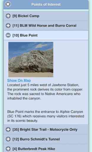
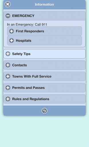
√ OpenStreetMap background layer can be turned on or off√ Zoom and scroll across the map√ Find your location (GPS enabled devices only)√ Track your movement across the map (GPS enabled devices only)√ Find and navigate to 38 back country destinations and points of interests√ New "Quick View" text shown beneath each destination pin when selected√ Obtain emergency and other contacts√ Find local services such as fuel, lodging and food√ Learn area OHV rules, regulations, and safety tips√ Legend of symbols on the map
Category : Travel & Local
Reviews (9)
Map is ok, points of interest unable to scroll down, basic
Worked well for me on a cheap LG phone. Find me function was a tad slow, but always worked. It does toggle. It would be nice to add markers. Sure beats carrying a map! And you can put your phone on airplane mode to conserve the battery.
Must have the base map setting turned off to look like the old map. In the setting page, use the little button at the bottom of the screen or the map won't change. Only gripe I have now is it won't stay zoomed in as close as I want sometimes.
Never be lost again. Get more out of riding the identified authorized trails
Love that the map comes up with no data, or service.
Very easy to use and hard to get lost.
Easy to use
Tried to install twice, downloads fine then causes phone to reboot during install, install doesn't complete. T-mobile G2 with 2.3
Kinda ticked that i bought this app, cant make markers. Got lost and turned to google maps, cause it was easier.... You cant make waypoints and doesnt tell you where to go...