GPS status & Surveying tools
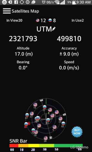
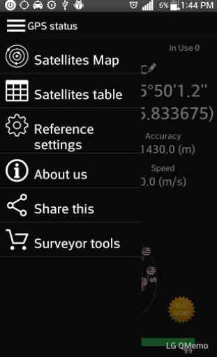
Displays GPS and sensor data: position and signal strength of satellites, accuracy, speed, acceleration, altitude, bearing.Tools included: Available many common reference systems, allows to set up more other reference systems.
★ GPS status & surveying tools
- Fast config
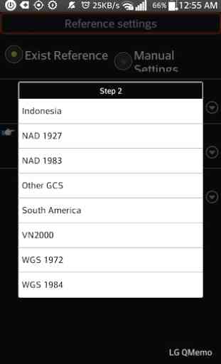
- Add all of WGS84 central meridian.★GPS status & surveying tools : Geodetic coordinates/UTM with:
- WGS1984
- WGS1972
- NAD1983/1927
- VN2000
- Austria NS
- Belgium 50
- Nouv Trig de France 1…This tool is designed for Civil Engineer, Surveyor, Civil Surveyor, Land Surveying and TopografiaPRO features:
- removed ads
★ GPS status & surveying tools
- Fast config
- Add all of WGS84 central meridian.★GPS status & surveying tools : Geodetic coordinates/UTM with:
- WGS1984
- WGS1972
- NAD1983/1927
- VN2000
- Austria NS
- Belgium 50
- Nouv Trig de France 1…This tool is designed for Civil Engineer, Surveyor, Civil Surveyor, Land Surveying and TopografiaPRO features:
- removed ads
Category : Tools
Related searches
Reviews (5)
Kam. H.
Jan 1, 2019
it was just what i was lookin 4 thankz
Kev. S.
Feb 24, 2017
Ads made it about useless
Pet. T.
Dec 13, 2015
In using the app for 30 seconds i had to dismiss (at a minimum) 7 ad screens. The app might be great but the frequency of ad screens made it unusable.
Lar. S.
Oct 4, 2016
Sat Coords are Great
Crashes whenever trying to open Map page.