ADMIRALTY H-Note
This App presents an alternative way to send hydrographic data by taking advantage of your devices GPS, camera and email software.
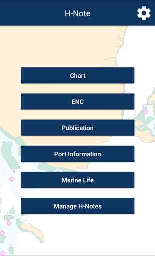
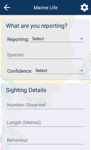
Mariners are asked to use the App to report information affecting ADMIRALTY charts and publication, issues with ENCs from our service, Marine Life information and any other dangers to navigation direct to the UKHO via the App.The H-Note App :
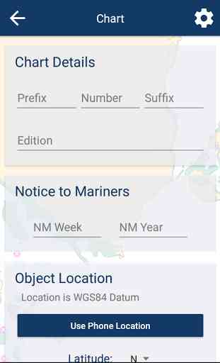
- Provides a simple form to enter details,- Can automatically include your current location coordinates using your device GPS- Can include images by either taking a photo or selecting existing photos from your gallery- Enables you to send the H-Note via your devices email software- Keeps a record of all H-Notes sent or saved.
When you submit an H-Note, you will receive an acknowledgement. The information will be assessed and verified to by the UKHO before taking immediate action or using the information is the next appropriate revision of a product.
Note: The UKHO reserves the right to reproduce any of the material supplied to improve the quality and safety of their products and service.
Please visit the UKHO website for more information on the H-Note and Maritime Safety; www.admiralty.co.uk/msi
Category : Business
Reviews (7)
Using 1 minute of arc on the earth = 6000 ft = 1 nautical mile to UNDERSTAND and use in a simple way for best accuracy to plot a position or scale off an object on a map when used for sailing walking flying and driving. This makes 1 second of arc = 100ft and does not interfere with use of statute miles or kilometers for engineering and construction. Degrees Minutes (or Miles nautical) and Seconds DMS. GPS plus all maps and charts are based on ARC latitude and longitude not survey miles and kilometres. Ideally the scientific standard should be an ancient 6000 ft nautical mile. Not an old random metal stick in London or Paris John.
Really nice app to report to ukho
thanks
Great little app, now I can report charting errors without filling out forms, transferring pictures ect. Great little time-saver. Thankyou Admiralty! High quality as ever!
Loved it
Excellent user experience and great notes management system.
Pls give us, some information + help for to know, how obtain new correction for any chart or pub...