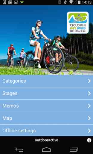
Alpe Adria Biketour
Alpe Adria Bike Tour
In one week from Salzburg to Grado. The route leads from Salzburg City of Mozart (elev. 425 m) through the Salzach and Gastein valleys to Böckstein. From here it’s an 11-minute train ride to Mallnitz (1,191 m), before hopping back on the bike and pedaling through Carinthia to Spittal a. d. Drau, Villach and Arnoldstein on the Austrian-Italian border. Now on Italian soil, the route takes us – partially along abandoned railway lines – via Tarvisio, Gemona, Udine and Aquileia all the way to Grado on the Adriatic Sea. Idyllic villages, impressive sights and imposing natural landscapes await you!
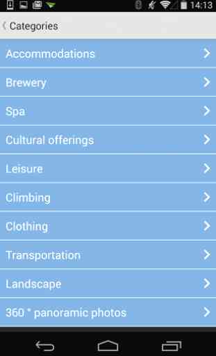
A substantial component of the App is complete information about each of the stages: routes, attractions and cyclist-friendly businesses.The tours/stages can be saved locally to your iPhone as needed (for example, when you are abroad, in areas with a weak signal, or when data roaming charges are simply too expensive) including all tour details and the relevant maps (Important: only online maps available at outdooractive.com can be saved for offline use!)
Key Features of the App:
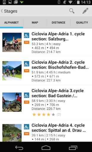
- Listing alphabetically: shows you all tours/stages in alphabetical order.
- Listing by distance: the tour list is sorted by distance to your own location
- Listing by tour duration: the tour list is sorted by the amount of time required for each individual tour/stage (if information is available)
- Search by location: a full-text search feature of the listing allows location-specific filtering of tours/stages.
The Google Maps App allows you to plan your ride to the starting point for each of the tours. Our App closes and your route to the start of the tour is shown in the Google Maps App (network connection required!)
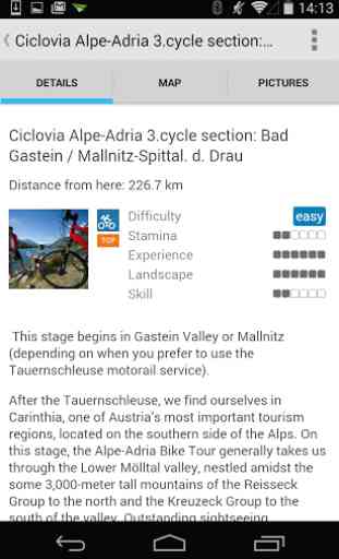
The tour descriptions contain all important facts, photos and elevation profiles. As soon as a tour is started, you can conveniently pinpoint your own position (including directional heading) on the topographical map and see where you are along the route.
Please be aware: On the iPod Touch, functionality is limited because there is no GPS receiver. In other words, you will not be able to pinpoint your position automatically. If you are within range of an existing W-LAN, you can approximate your position by the location of the hotspot, which is nowhere near as precise as having GPS capability on your own phone. For outdoor purposes, this type of positioning simply isn’t adequate. 3G devices are recommended.
Important: When you are abroad, you might well incur high data roaming charges, which is why, if you use the App, you should download all the information you need using your unlimited plan, or offline via W-LAN prior to your trip. If you run the App in the background with GPS activated, your battery life may well be drastically shortened!
In one week from Salzburg to Grado. The route leads from Salzburg City of Mozart (elev. 425 m) through the Salzach and Gastein valleys to Böckstein. From here it’s an 11-minute train ride to Mallnitz (1,191 m), before hopping back on the bike and pedaling through Carinthia to Spittal a. d. Drau, Villach and Arnoldstein on the Austrian-Italian border. Now on Italian soil, the route takes us – partially along abandoned railway lines – via Tarvisio, Gemona, Udine and Aquileia all the way to Grado on the Adriatic Sea. Idyllic villages, impressive sights and imposing natural landscapes await you!
A substantial component of the App is complete information about each of the stages: routes, attractions and cyclist-friendly businesses.The tours/stages can be saved locally to your iPhone as needed (for example, when you are abroad, in areas with a weak signal, or when data roaming charges are simply too expensive) including all tour details and the relevant maps (Important: only online maps available at outdooractive.com can be saved for offline use!)
Key Features of the App:
- Listing alphabetically: shows you all tours/stages in alphabetical order.
- Listing by distance: the tour list is sorted by distance to your own location
- Listing by tour duration: the tour list is sorted by the amount of time required for each individual tour/stage (if information is available)
- Search by location: a full-text search feature of the listing allows location-specific filtering of tours/stages.
The Google Maps App allows you to plan your ride to the starting point for each of the tours. Our App closes and your route to the start of the tour is shown in the Google Maps App (network connection required!)
The tour descriptions contain all important facts, photos and elevation profiles. As soon as a tour is started, you can conveniently pinpoint your own position (including directional heading) on the topographical map and see where you are along the route.
Please be aware: On the iPod Touch, functionality is limited because there is no GPS receiver. In other words, you will not be able to pinpoint your position automatically. If you are within range of an existing W-LAN, you can approximate your position by the location of the hotspot, which is nowhere near as precise as having GPS capability on your own phone. For outdoor purposes, this type of positioning simply isn’t adequate. 3G devices are recommended.
Important: When you are abroad, you might well incur high data roaming charges, which is why, if you use the App, you should download all the information you need using your unlimited plan, or offline via W-LAN prior to your trip. If you run the App in the background with GPS activated, your battery life may well be drastically shortened!
Category : Travel & Local
Related searches