Arkansas Hiker
After the initial setup the app is fully functional without an internet connection: NO MOBILE OR INTERNET CONNECTION REQUIRED because the app uses your device's GPS and offline topo maps.
The free demo covers the Pinnacle Mountain State Park trail system, along with 20 miles of the eastern end of the Ouachita Trail.
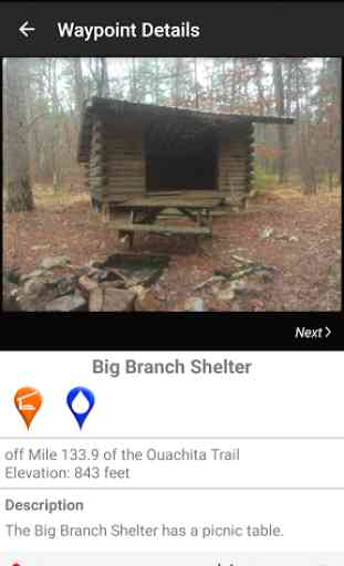
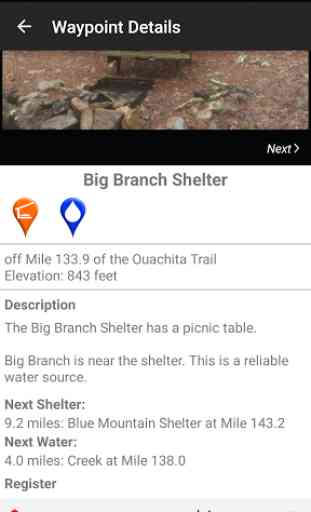
An elevation profile shows path distance vs elevation and plots your current location. Each waypoint is plotted on the profile. Each waypoints is clickable, opening to the waypoint's detail page.
A guidebook lists every waypoint in order by distance along the trail and displays your current distance from each waypoint.
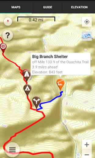
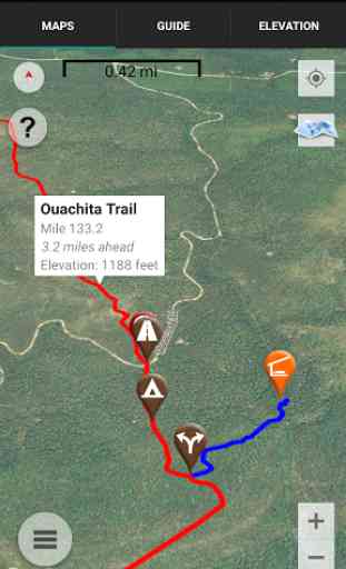
The types of waypoints include:
-->Water sources (including the reliability of each water source)-->Shelters-->Tenting sites/camping sites-->Trail junctions-->Trailheads and parking areas along the trail-->State and Federal campgrounds-->Roads crossings, railroad tracks, power lines-->Natural landmarks (e.g. views, ponds)-->Privies/restrooms
Category : Travel & Local
Reviews (11)
Used it on the Eagle Rock Loop. Very accurate and dependable.
nothing about this app is free. 9.99 for a map. moving on and delete.
4 of the best hikes in Arkansas with offline mapping
Useless compared to All Trails app
Keeps me on trail
This app saved me from getting lost on Eagle Rock Loop a few times. It was also great to see where I was and the distances to waypoints whenever I needed to. Works well offline.
App is free until you download it, then want to charge you $20 for each trail! A complete rip off!
Did the Eagle Rock loop. This app and permethrin were the VIPs of the hike.
We used the app offline for Eagle Rock Loop this weekend which helped but we still had to refer to the map we printed from the website. I'm planning to go back in a few weeks t.p try using again! Thanks for the app
An app with nearly no hikes, no information, and a bad format and design. It's all just a blank Google map of Arkansas. It's a shame though because Arkansas is one of my favorite states for backcountry travel.
It's been Great experience sofar. Being able to know where your next water source is and how far you have traveled at any point of the day is a great feature.