Atlas of Fiji for mariners
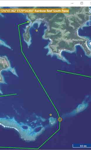
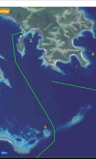
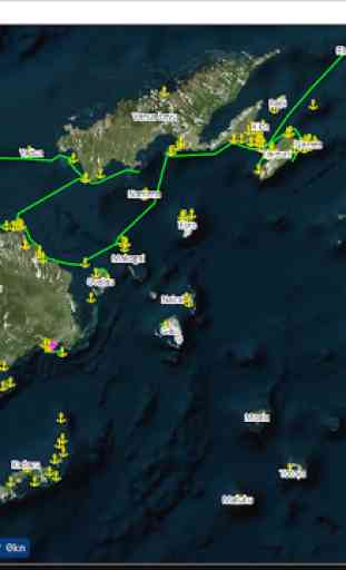
Mapping application for mariners to sail using georeferenced satellite images that are more precise and reliable that any chart in Fiji. Run off-line for use at sea in the cockpit. Provided with a set of routes and points of interest (anchorages...) that you can to import into your navigation software (OpenCPN...), GPS or plotter.
Category : Travel & Local
Related searches
Reviews (2)
CB.
Mar 26, 2017
Good app. Waypoints are spot on.
what are the yellow dots?