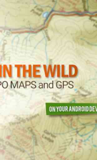
BackCountry Nav Topo Maps GPS
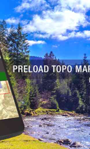
Use offline topo maps and GPS on hike trails without cell service! The GPS in your Android phone can get its position from satellites, and you don’t have to rely on your data plan to get maps. Have more fun and safe GPS adventures in the backcountry.Preload FREE offline topo maps, aerial photos, and road maps on your storage memory, so they are ready when you need them.
Add custom GPS waypoints in longitude and latitude, UTM or MGRS grid reference. Import GPS waypoints from GPX files. Choose icons for waypoints much like in MapSource. (This app uses the WGS84 datum, NAD27 is available in settings). Use GPS for hunting a waypoint or geocache, for recording tracks and GPS waypoints on your trip, all the while tracking your quest on topographic maps.
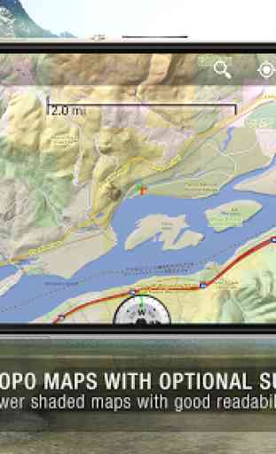
About topo (topographic) maps: Topo maps show terrain through color and contours, and are useful for navigation offroad. Topo maps and GPS can be used for hiking, hunting, kayaking, snowshoeing, & backpacker trails. The app has many built in map sources and allows you to create your own maps with Mobile Atlas Creator. Built in sources include:OpenStreetMaps and NASA landsat data worldwide. OpenCyle Maps are topo maps that show terrain worldwide. USGS Color Aerial photography. Topographic Maps of Spain and Italy. Outdoor maps of Germany and AustriaTopo maps of New Zealand
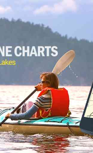
Here are some of the outdoor GPS activities BackCountry Navigator has been used for:Hiking both on hiking trails and off trail. Camping, to find the perfect camping site or the way back to camp. Hunting trips for hunting wild game in rugged areas, including recon for the hunt.Bait fishing or fly fishing with a buddy. Search and Rescue (SAR) with GPS. Kayak and canoe trips on inland lakes and streams or marine, coastal waters. Backpacker trips: using topo maps of wilderness areas and national forests to navigate on trails with the GPS. Snow adventures including snowmobiling, skiing (alpine or cross country) and snowshoeing. Create a memory. Map it out.
This a great addition to the outdoor gear you bought at Cabelas, REI, or another outdoor store. Your android phone could substitute for a Garmin or Magellan outdoor handheld GPS! You storage has memory for maps.
Find your own ways to have fun in the outdoors. Be a maverick by venturing into new territory beyond cell service boundaries. Become a pro at navigation with GPS. BackCountry Navigator has been previously available on WM devices and preloaded on the Trimble Nomad outdoor rugged device. This Android version is more flexible, featured, and fun.
Category : Maps & Navigation
Reviews (25)
I can't sing enough praises of this app. It does everything any outdoor GPS unit ever did, runs in out of coverage areas, and has the most extensive set of worldwide hiking maps I've seen. This last perk is really special: in many countries around the world there simply aren't good maps available for outdoor enthusiasts, but Backcountry Navigator has them all! I never review anything but for this app I am making an exception. I would give it 6 stars, or even 7 if it was possible.
Fantastic app!!! Easy to use, reliable, cross-compatible, and full featured without forcing you to buy needlless subscriptions and maps. It is an indispensable tool in planning and hiking any trip of any length. We have used this on nearly 50 trips in 4 years. Its coming on our SOBO thru-hike of the AT this year. The demo is completely capable, but this deserves support for the developers. As a software developer, thank you for the great work you do.
.... update... the recent version made this worse. now, force stop doesn't even close it. Previously workable, now completely unusable. I have to delete as my battery will die within half a day. ... great app. a little buggy on closing though. Even when closed, the app continues in the background. I need to"force stop" each time i close or it drains my battery heavily. maybe an update can address this?
The best app for cross country navigation in Europe and US I found and tested. And I tried quite a number. Accurate, low energy use, easy to use once you learned basic fuctions. The demo is wholly functional with all important features intact which is rare. Upgraded to paid version as a way of saying thanks to the developers.
Great navigation app. Very usable free version. Different maps for cycling and walking. Some maps have all trails. The only app that comes close to paper. Finally bought it after great usage for 180 days to support the developers and get rid of the "This is a demo" pop up
Used the demo version for a good 3+years and just kept meaning to upgrade. Sale offer so finally did! Use this constantly for MTBing & walking etc. Super useful. Love offline maps. Only rated 4 because menus are difficult to use: symbols not words so need to memorise functions, which I find tough. Functionality terrific though.
Amazing app, buy the pro it is totally worth it. We've been using it to survey trail systems for a year and it works exactly as advertised. Its stable and reliable, but a few rough usability edges. Overall it's the best out there.
I've been using the full paid version for several years now. It works well but I really need the ability to add my own icons for waypoints. Most of what's available are pointless and huge. A basic set of small different colored dots would be great.
Excellent app, having access to full OS UK maps is great. I use the application for walking as well as geocaching and it is always accurate and has never given me any problems. I highly recommend that you upgrade to the full version.
Most likely user error but I just couldn't get to grips with the app. I switched to United Kingdom, and it is very detailed but blurry on the screen ( tablet) I probably just need something simpler, personally.
I got the pro version when it went on sale. I like this one over Gaia because it is easier to import .gpx files and overlay them on a map. I also like the layer options better than Gaia. Offline maps and zoom levels can be finicky.
I just wanted a hiking gps that I could use offline, import/export gpx files, didn't have all the extra social fluff, and did not require a subscription. After looking at several other apps and being disappointed, this seems to fit the bill nicely.
Not very accurate, cannot believe paid version is any better. Set way points then tryed to follow them back. Well they wer e out by about 100 yards ( that a low side guess) with would be fine on the flat cleared land, but add trees and land features not so great.
Very good app, I've used for years. Clear zoomable OS maps for UK. Gpx file overlays. Have tried other map apps always come back to this.
I use this app for hunting and side-by-side rides and walking my dog and this is the most comprehensive app I have found yet even the demo version. There are so many things you can do with this app it's amazing. I use this app with the upmost confidence even offline with no data usage.
Generally serves the purpose, but the interface is so hard to use! And annoying features that keep popping up to ask you to upgrade.
The only map layers accessible on the demo is "thunder forest" which is a worthless layer imo. I have an old demo version on an old phone and alot of the layers work on that.
When I open coordinates with this app (instead of the default google maps) it always creates a way point or centers at 0,0 (where the equator intersects the prime meridian). Fix this please, I need this feature.
Quite baffling. It happily imports gpx files but there's no hint as to how you would start navigating. I can't find anything to suggest it would speak turn by turn instructions, even though it has a list of instructions. I'm not sure what it's for to be honest.
Being An Armed Forces person I find it very useful for Navigation Purpose. Accuracy on topographical heights are really remarkable. Thanks For Developer of this App.
I only use Backcountry Navigator because it is convenient, and my Phone is the only device I carry with me every day. I can do everything on it. I can use it for navigation. I can use it as a compass, and I can record routes and much, much more.
Only bitmapped maps, very difficult to make routes, sluggish and old fashioned to use. Idea was perfect 4 years ago.
I'm an Archaeologist and I do a lot of work in National Forests and this app has been extremely helpful. It's possible it even saved my life when my work GPS battery died close to sunset.
just needs more points of interest and trails otherwise priceless gps navigate. must have. thanks devs! worth $100 for some issues.... easily with 12$ for the service. again ty
Generaly useful. One issue I have is simple functions like goto or measure distances are buried and difficult to find. It would seem logical to have basic functions available from the home screen or main menu page. Another issue I have is the names of waypoints are in a small black font and difficult to read on a dark map. It would be useful to be able to change the font color.