Bearing + Distance USA
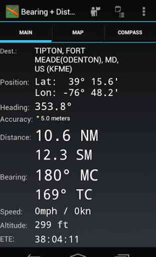
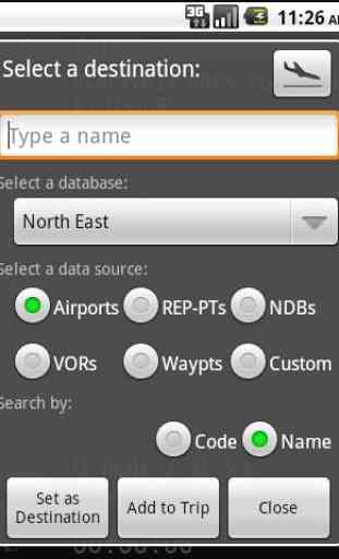
The best deal in mobile aviation software with a new lower price! Created just for private pilots, B+D USA puts a complete database of every public airport, VOR, NDB, Waypoint, and major Reporting Point in your pocket. Pick one, and instantly get the Bearing (true + magnetic) and Distance to the fix using your GPS coordinates.
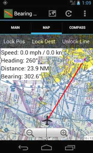
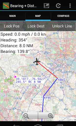
Includes aviation compass w/ADF, robust trip system, map view w/cross track error calculation, rotating maps and offline support, "Nearest Destinations" feature, Custom destinations (add your own, anywhere in the world), "track recording" to KML files for use in Google Earth, fuel calculator, FAA document downloader & lots more..
Also includes FREE (with purchase) access to dedicated VFR map server. No annual subscription fees!
Contains more than 23,000 destinations, including 5,727 airports, spanning all of the USA and Canada.
*
* By buying "USA", you get 8 databases for less than price of 4. Don't need all of the US? Find versions for different regions of the US (and other countries) by selecting "View More Applications", below, for $7.99 each. **
Category : Maps & Navigation
Related searches
Reviews (4)
A. G. u.
Jan 17, 2016
This was my favorite aviation app. However, it looks like support has ended. Maps no longer available. Database can't be trusted
A. G. u.
May 23, 2011
Very capable backup navigator. I bought the USA version. My only current complaint is having to switch between sections to find an airport. Se,ne,sw
A. G. u.
Apr 24, 2011
Won't recognize Gps making application worthless. Please refund or resolve problem.
I started with the Lite version and was hooked. I bought the SE version next thinking that would satisfy my needs. Finally, I couldn't resist the US version, and wish I'd have sprung for it in the beginning, but that is in hind sight. I'm not saying there is no room for improvement, but this app rates right up there is dedicated moving map portable GPS receivers. I use it every time I fly now. I don't always have the sectionals cached, and so sometimes I revert to the data screen, but I believe there is a way to cache your route prior to flight to avoid that necessity. It's a secondary source for me, but it's fantastic. I learned to fly on steam gauges and under the old airspace classifications (TRSA, ARSA, TCA, etc...) and frankly the environment was pretty forgiving back then. The hotest thing going was LORAN. Busting airspace is a much bigger deal than in the past, so having a GPS for situational awareness is very nice. I've flown with friends using their big name portables, and for the price, this app compares well. It's not WAAS and some of the bells and whistles aren't there. However, for graphic representations of your position on sectionals, it is great.