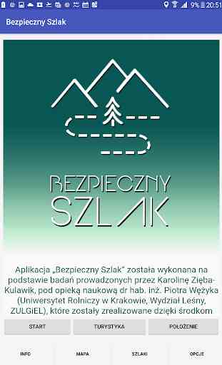
Bezpieczny Szlak
The "Safe Route" was made on the basis of research conducted by Karolina Zięba-Kulawik (under the scientific supervision of Assoc. Eng. Peter Wężyk; University of Agriculture in Krakow, Faculty of Forestry, ZULGiEL). The project was realized thanks to the financial measures in the framework of Scholarship. Anna Pasek, ninth edition, 2016/2017 (www.annapasek.org).
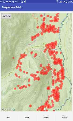
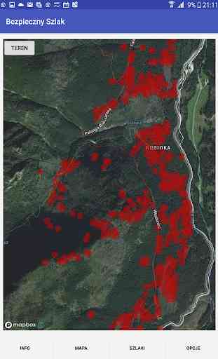
Test results Fri. "Monitoring and evaluation of landscape changes and Tatra Gorce with particular emphasis on forest complexes using LIDAR and remote sensing data in the aspect of safety in the mountains. The choice sections on hiking trails in the TPN and GPN vulnerable due to the presence of dead trees "implemented in the submitted mobile application that used in the right way can help to increase security in the Gorce and Tatra trails.
In the application "Safe Road" presented layers of hiking trails and locations dying stands and highlights sections of routes because of dangerous hazardous dead trees. When extinguished the map, the application warns of impending risk area from occurring by means of an audible message and the label that appears on the screen. Additionally, the application offers the following functionality: the ability to view maps Gorce and Tatra National Park (map "Land" and "Satellite"), hiking (with descriptions: długoość route, transit time) and characteristic places (hostels, tops). The application allows you to record a GPS track, taking pictures and display of current coordinates with the possibility of sending coordinates via SMS or e-mail. Through the application, you can transfer the application to the GPN or TPN (e-mail) and you will find general information on mountain safety and emergency phones. For reasons of license applications can use up to 50,000 users per month.
The application uses maps from the Open Street Map project, which can be downloaded and used offline, which is necessary to operate in an area where it is not always available cellular network with adequate bandwidth.
Category : Maps & Navigation
Related searches