
Centerline Maps GPS
Download Centerline Maps for your next outdoor adventure!
Centerline Maps is a multisport handheld GPS built for the outdoors providing various map layers and live weather conditions to track your location on land and water.
Used for kayaking, hiking, boating, sailing, hunting, fishing, biking, and much more.
View interactive map layers including:
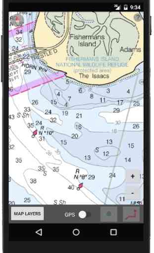
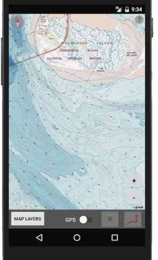
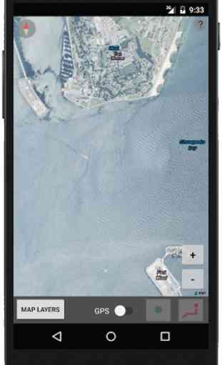
Global Aerial Imagery Global Terrain and ContoursUS Topographic MapsUS Nautical ChartsUS Radar and PressureUS Wind Speed and DirectionGlobal Sea Surface TemperatureSea-Level Pressure (mb)Horizontal VisibilityDew Point Temp. (F)Significant Wave Height (ft)3-Hr Pressure Change (mb)Cloud Cover (oktas)World Streets
Version 1.9
New features and map layers coming soon!
Centerline Maps is a multisport handheld GPS built for the outdoors providing various map layers and live weather conditions to track your location on land and water.
Used for kayaking, hiking, boating, sailing, hunting, fishing, biking, and much more.
View interactive map layers including:
Global Aerial Imagery Global Terrain and ContoursUS Topographic MapsUS Nautical ChartsUS Radar and PressureUS Wind Speed and DirectionGlobal Sea Surface TemperatureSea-Level Pressure (mb)Horizontal VisibilityDew Point Temp. (F)Significant Wave Height (ft)3-Hr Pressure Change (mb)Cloud Cover (oktas)World Streets
Version 1.9
New features and map layers coming soon!
Category : Entertainment
Related searches
Great App! It is very detailed and works smoothly. Would definitely recommend!