CTUC BLM Amboy Area Trail Map
The CTUC BLM Amboy Area Trail Map App brings the popular 1st print edition CTUC Amboy and Mojave National Preserve Map to your Android mobile device.
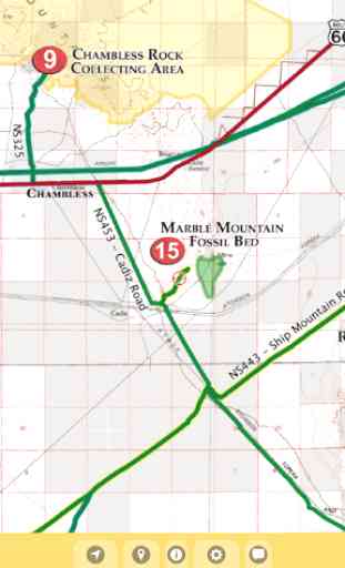
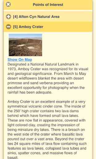
View the map in several zoom levels and navigate to popular destinations throughout the area. The map covers 1.5 million acres of world-class OHV recreation lands from beautiful Afton Canyon to the world famous Route 66. Depicted on the map are hundreds of miles of legal, designated OHV roads and trails, as well as OHV Open Areas, wilderness areas, State Parks, military bases, and other public and private lands.
The map features OHV routes managed by the Bureau of Land Management's Barstow and Needles Field Offices, Mojave National Preserve, and San Bernardino County.
Featured within the app are:
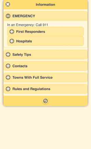
√ OpenStreetMap background layer can be turned on or off√ Zoom and scroll across the map√ Find your location (GPS enabled devices only)√ Track your movement across the map (GPS enabled devices only)√ Find and navigate to 38 back country destinations and points of interests√ New "Quick View" text shown beneath each destination pin when selected√ Obtain emergency and other contacts√ Find local services such as fuel, lodging and food√ Learn area OHV rules, regulations, and safety tips√ Legend of symbols on the map
View the map in several zoom levels and navigate to popular destinations throughout the area. The map covers 1.5 million acres of world-class OHV recreation lands from beautiful Afton Canyon to the world famous Route 66. Depicted on the map are hundreds of miles of legal, designated OHV roads and trails, as well as OHV Open Areas, wilderness areas, State Parks, military bases, and other public and private lands.
The map features OHV routes managed by the Bureau of Land Management's Barstow and Needles Field Offices, Mojave National Preserve, and San Bernardino County.
Featured within the app are:
√ OpenStreetMap background layer can be turned on or off√ Zoom and scroll across the map√ Find your location (GPS enabled devices only)√ Track your movement across the map (GPS enabled devices only)√ Find and navigate to 38 back country destinations and points of interests√ New "Quick View" text shown beneath each destination pin when selected√ Obtain emergency and other contacts√ Find local services such as fuel, lodging and food√ Learn area OHV rules, regulations, and safety tips√ Legend of symbols on the map
Category : Travel & Local
Related searches