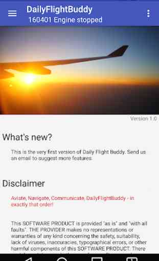
DailyFlightBuddy - VFR/NVFR
DailyFlightBuddy helps you navigating during the flight - VFR/NVFR
From pilots - for pilots. Your personal flight planning and flight capture tool
This APP needs some permissions - scroll down to learn more...
Start your flight with a few little steps.
Step 1: Check your Airports and Waypoints
Step 2: Create a flightplan
Step 3: Fly!
Highlights:
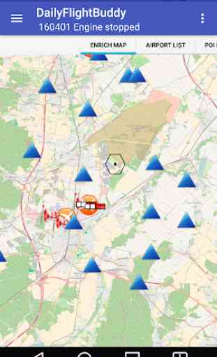
✓ 19.000 Airspaces
✓ 40.000 Airports/Heliports
✓ 70.000 POI (Points of Interest)
✓ 1.000.000 Cities
✓ During the flight the APP can operate without an internet connection.
✓ Support for airspaces - KML and Airspace format is now supported
✓ Online map while creating your flightplans
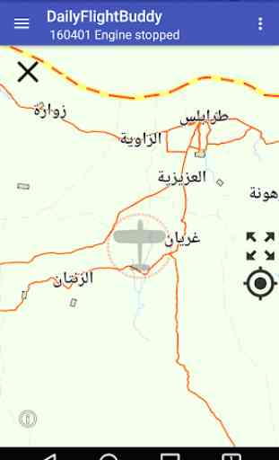
✓ Offline map during the flight
✓ GPS rolling map
✓ Worldwide maps
✓ Terrain data
✓ Create your flightplans
✓ Captures your flight
✓ Backup at Server
✓ Tablet Support
✓ Automatically detect engine start/engine stop event
✓ Nearest Airports, Nearest Beacons
✓ Aided setup of the system
✓ Speech support (premium feature)
✓ Scratchpad
✓ Day- and Night theme (premium feature)
✓ Measurement units
✓ Drag'n'drop in the map
✓ Management of your licenses
✓ METAR/TAF/NOTAMs for Airports
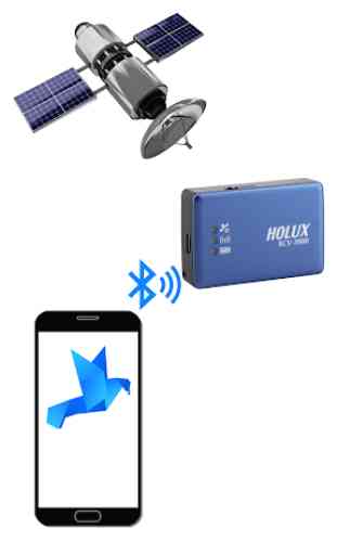
✓ Send GPS data via bluetooth from one device to another
✓ Receive GPS from an NMEA GPS tracker via bluetooth
✓ Add files (images or PDF) to Airports
✓ Visual terrain warnings
From pilots - for pilots. We encourage you to send us an email with suggestions.
Necessary permissions:
• Location Needed during the flight for GPS
• Modify contents of the SD Card Worldwide maps will be downloaded and stored at the SD Card
• Manage accounts The account to the DFB Server will be managed by the android accounting service
• Network access Worldwide maps will be downloaded
• Prevent from sleeping During flight the screen will not go to sleep
• Sync settings The data will be synced with the DFB server
• Microphone The APP automatically recognizes engine start/stop events
• Capture Photos When capturing photos of pilots or airplanes
• Bluetooth to send GPS data from one device to anothe
From pilots - for pilots. Your personal flight planning and flight capture tool
This APP needs some permissions - scroll down to learn more...
Start your flight with a few little steps.
Step 1: Check your Airports and Waypoints
Step 2: Create a flightplan
Step 3: Fly!
Highlights:
✓ 19.000 Airspaces
✓ 40.000 Airports/Heliports
✓ 70.000 POI (Points of Interest)
✓ 1.000.000 Cities
✓ During the flight the APP can operate without an internet connection.
✓ Support for airspaces - KML and Airspace format is now supported
✓ Online map while creating your flightplans
✓ Offline map during the flight
✓ GPS rolling map
✓ Worldwide maps
✓ Terrain data
✓ Create your flightplans
✓ Captures your flight
✓ Backup at Server
✓ Tablet Support
✓ Automatically detect engine start/engine stop event
✓ Nearest Airports, Nearest Beacons
✓ Aided setup of the system
✓ Speech support (premium feature)
✓ Scratchpad
✓ Day- and Night theme (premium feature)
✓ Measurement units
✓ Drag'n'drop in the map
✓ Management of your licenses
✓ METAR/TAF/NOTAMs for Airports
✓ Send GPS data via bluetooth from one device to another
✓ Receive GPS from an NMEA GPS tracker via bluetooth
✓ Add files (images or PDF) to Airports
✓ Visual terrain warnings
From pilots - for pilots. We encourage you to send us an email with suggestions.
Necessary permissions:
• Location Needed during the flight for GPS
• Modify contents of the SD Card Worldwide maps will be downloaded and stored at the SD Card
• Manage accounts The account to the DFB Server will be managed by the android accounting service
• Network access Worldwide maps will be downloaded
• Prevent from sleeping During flight the screen will not go to sleep
• Sync settings The data will be synced with the DFB server
• Microphone The APP automatically recognizes engine start/stop events
• Capture Photos When capturing photos of pilots or airplanes
• Bluetooth to send GPS data from one device to anothe
Category : Maps & Navigation
Related searches
This app has potential. But it crashed most often.