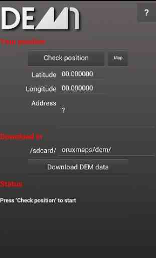
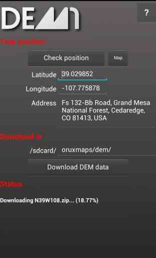
DEM1 - World Elevation Data
DEM1 eases the download of those models in SRTM standard (.hgt extension), wich is used to several apps, like OruxMaps. The data downloaded by DEM1 are, specifically, in SRTM1 standard, what means that its resolution is the best available at the moment in this format (1 arcsecond, or ~100 feet) which is much better than the commonly downloaded by other apps, in SRTM3 standard (3 arcsecond, or ~300 feet).
The advantages of using such precise data are evident. Often, when we are planning a route at home, we don't have a precise perception of our track's profile, something vital if we practise mountain bike or trekking. Other times, we found ourselves in the middle of the mountain, with mist, and equipped with a GPS navigator with a map that doesn't include accurate contour lines (like ortophotos, most of the online maps and several offline).
Differences between SRTM1 and SRTM3 are obvious, and easily appreciable opening a map in any viewer, switching from a SRTM3 and a SRTM1 DEM.
Complete World coverage.
Category : Travel & Local
Reviews (10)
Option to not unzip files would be good. Changing download directory difficult on small screen as keyboard obscures field.
Click on the banner (you don't have to actually follow the link) to activate data set selection by map. No data source information :-(
Unless you click on an ad. Which I don't do. So it's uninstalled.
Not only this app requires you to click on an ad to be useful, it also shows an annoying full screen ad when you leave the application. 90ties shareware is calling ...
It would be even better if that were possible without the need to click on an ad first.
Get rid of the ad
Tap over the pub to see the map.. ha ha.. what pub? There is no pub to tap!
Maybe I missed something, but what good is an elevation app that doesn't show elevation?
Simply Outstanding
The interface could be smoother and less confusing (you never really know what you have -and what you need to download- until you actually get to the download step) , but in the end it works great and can be easily used by Oruxmaps so it's a winner! If you give this a for-pay option (even if its an annual renewal), I'd give it five stars.