Disaster Surveyor (International version)
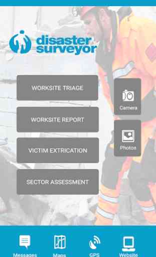
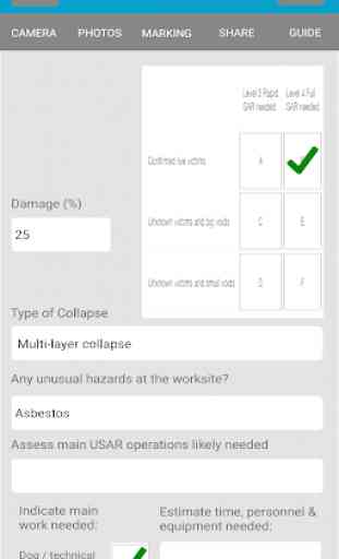
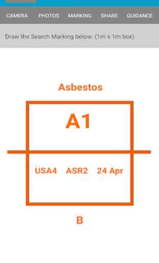
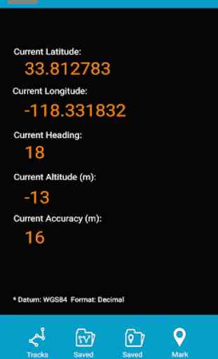
Disaster Surveyor is a dedicated smart device app, designed by and for international and domestic first responders for collecting information to help coordinate search and rescue operations. Using standard United Nations INSARAG forms, FEMA and UNOCHA icons for waypoints, ability to attach photos, upload forms to a web-based manager, hand draw any sketches for each form, mark waypoints with standardized icons, create tracks and waypoints that can be exported to KML or GPX formats for import into ArcviewGIS or other mapping solutions! Disaster Surveyor provides a complete solution to your emergency team coordination needs.
IMPORTANT NOTE: Not all Android devices contain a dedicated GPS chip, but even those that do, in the event of no Wifi signals and no Data signal areas (open ocean, high desert, steel/heavy concrete buildings), the GPS feature may not work. We recommend adding a dedicated GPS attachment for these purposes.
TEAM MANAGERS/LEADERS: Please contact [email protected] for having your Disaster Surveyor account upgraded to the Commander edition that can see all your team members on the website who have signed up with the same team code in the app.
Category : Tools
Related searches
Reviews (3)
Ste. S.
Jan 25, 2019
Great USAR tool for gathering information. Great updates.
Ale. Y.
Jun 28, 2018
It keeps getting better and better. Thank you to all our USAR heroes that continue to give us their constructive feedback!
Very good, but it does have limited international scope due to to lack of language accessibility. Do you have any plans to offer this in other languages? I could help get it (and the supporting documentation online) translated into Spanish.