DroneMaps
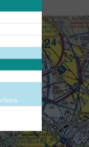
You'll use the compass icon to center the map on your location. Then click on the layer icon to select a base layer and overlay.
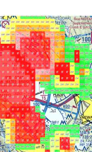
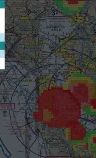
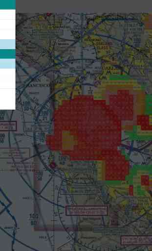
Base layers include Google Maps and FAA Sectionals. You can toggle UAS Facility Maps as an overlay on one of the base layers.
UAS Facility Maps show the maximum altitudes around airports where the FAA may authorize part 107 UAS operations without additional safety analysis. These maps DO NOT authorize operations in these areas at the depicted altitudes – they are for informational purposes ONLY.
DroneMaps is a work in progress and I plan on releasing more layers in the near future. If you have any suggestions please reach out to me on YouTube: https://www.youtube.com/dennisbaldwin
I developed DroneMaps using React Native because more and more of my users are asking for Android support. I hope to bring DronePan, DroneBlocks, and Droneception to Android using RN.
Category : Tools
Reviews (9)
Wow, this app is great for the drone flyer looking for good online FAA sectionals with their sUAS overlay! I would love to see the sectionals updated and the mapping moved to OpenStreetMap, but otherwise this is solid!
the only thing I wish it did is open to the map settings i had it on win i closed it
SFO Function stop working! Delete.
nice and clear... easy to use
Does exactly what it says, places UAS Facility Maps, TFR's and National Security Flight Restriction on the basemap of your choice; Google Maps or FAA Sectional. I had some issues with my Android version, Dennis responded quickly and I received an updated version within hours.
Thank you for making something for us Android users. Feature request would be to have TFRs and NOTAMs intergraded in the layers too. Also the UAS Facility maps is not fully up to date. Missing some areas that just came out on Friday.
Does not work in one plus 5t. Crashes after selecting layer
Very useful, eliminated three other apps
A much needed map!! I really like the way you do the "UAS Facility" layer with heights in feet and colors. This helps me out a lot