Droners Helper
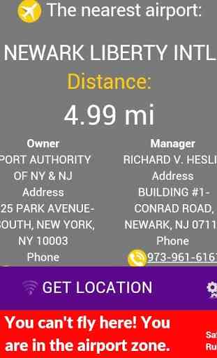
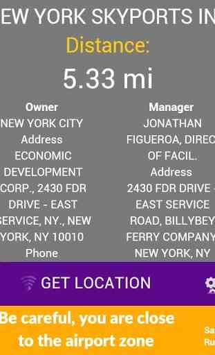
Droner’s helper is a cellular application that automatically locates the drone/UAS operator by utilizing real-time data and informs him or her of the their exact distance to the nearest airport.
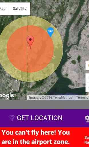
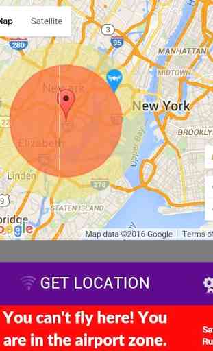
This aids the droner to stay in accordance with "Safety Zone" rules set out by the FAA, which stipulates a 5 mile drone free radius around the nearby airport.
Specifics can be found under Section 333 of the FAA Modernization and Reform Act of 2012 (FMRA) Subtitle B – Unmanned Aircraft System, Sec. 336. Special Rule for Model Aircraft: "Never Fly within 5 miles of an airport without first contacting air traffic control and air port authorities".
Features:
- Detailed information about airports, including addresses, phone numbers, etc.,
- Distance to the nearest airport,
- Show on Map – show sets a 5 mile radius around the closest airport, in addition to the actual position of the drone/UAS operator,
- Settings include a filter to select airports, as well as helipads and seaplanes,
- Safety Rules – an index of applicable FAA & AMA safety rules ,
- Auto Locate uses your current GPS position upon startup, yet also locates on the basis of either WiFi or Internet connection,
- Application contains all over 19,000 airports in the USA
Currently available in the following countries: USA
Location data may not be accurate.
Use of this app is at your sole risk.
Category : Tools
Related searches
Reviews (2)
Myl. B.
Jul 12, 2016
Needs "APP 2 SD"!!! Won't find/connect to GPS!!!!!
They list a hospital as an airport!