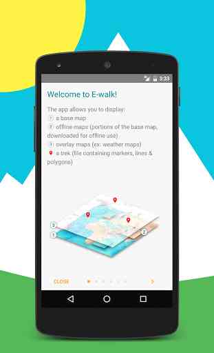
E-walk Free - Offline maps
E-walk allows you to download offline maps, to plan your treks, to show and share your position, to record your treks, etc... This makes E-walk the perfect companion for outdoors activities (such as trekking, hiking, fishing, hunting, etc...) and for traveling abroad, because you can fully use it offline.Lost in a forest? E-walk brings you back to your car. Forgot about where was this lovely boutique you noticed last year in Venice? E-walk refreshes your memory!
E-WALK KEY FEATURES
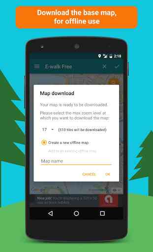
• download maps for later offline use
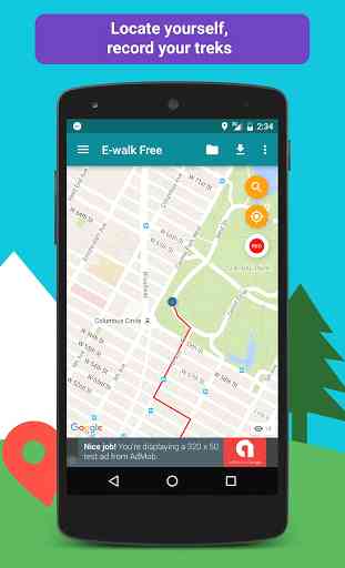
• show your current location on the map
• search places (last searches are saved for offline use)
• record your treks
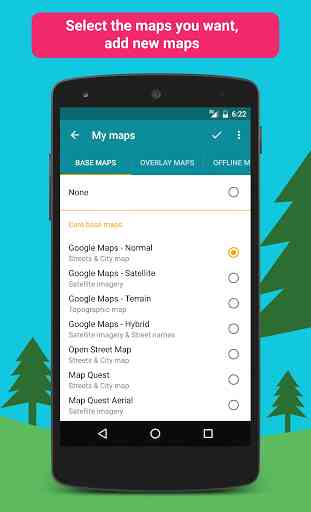
• select different base maps (streets, satellite, terrain, etc...)
• plan your treks by creating and editing KML files on the map. A KML file can contains markers, lines & polygons
E-WALK ADVANCED FEATURES
• organize your treks in folders & subfolders
• display overlay maps (weather, roads, metro/bus, ski slopes, sea map, etc...)
• share your position via e-mail or SMS
• open a position in your other geo apps (such as Google Maps, Waze, TomTom, Sygic, Locus, Orux, MyTrails, etc...)
• share a trek by e-mail, bluetooth, etc... Either in KML file format (by default) or in GPX file format
• import GPX files (they will be converted in KMZ format)
• add custom maps in the XYZ protocol (see http://wiki.openstreetmap.org/wiki/Slippy_map_tilenames)
• add custom maps in the WMS protocol (version 1.1.1 & 1.3.0 are supported, Web Mercator coordinate system only. See https://en.wikipedia.org/wiki/Web_Map_Service)
E-WALK WITHOUT ADS
Sick of ads? Get the paid version of E-walk !
E-WALK PLUGINS
Some plugins are available for E-walk (a plugin is an app that adds features to another app). You can download them here:
• IGN maps: this plugin adds maps provided by the french national institute of geographical and forestry information (http://www.ign.fr). These maps are the same as the ones used by the Géoportail website (http://www.geoportail.gouv.fr). The plugin also allows you to use the IGN Leisure Space (http://espaceloisirs.ign.fr). It is a website providing points of interest and treks that you can synchronize on your device.
• ONCFS maps: this plugin adds maps provided by the french national office for wildlife and hunting (http://www.oncfs.gouv.fr)
CONTACT
A problem with E-walk? A suggestion? A feedback? Please do not hesitate to send an e-mail to [email protected] !
Category : Travel & Local
Reviews (25)
Powerful little app. Have been using for a few years now. Reliable and stable with a plethora of different maps to choose from. I use this to explore FSR's and the map choices are pretty accurate with the ever changing forest service roads. Very fast and helpful service if I have questions.
Excellent hiking app. Very impressed by its capabilities. Easy to use interface, maps are easy to download. Have used E-walk in very remote areas and has tracked new routes and followed existing gpx imports with no issues - all perfectly in offline mode. I did have an issue with gps dropping but thanks to the devs response and solution this edited review reflects as such. Thank you so much!
Keep crashing when downloading maps for offline use [FIXED] Been using this app on all my hikes, it's best one i can find here! Hope there will be some more features soon
One can only purchase "no ads", but everything worthwhile is still only available by means of additional subscriptions, via an idiotic configuration of requiring an additional plug-in to obtain maps and such, for which customers are then bled dry ad infinitum with recurring subscription fees. There are superior competitor products in the Play Store that can be bought instead of rented, which is why this milkingware has been replaced with a better alternative and is therefore being uninstalled.
Fantastic app! Has EVERY trail, both marked and unmarked, in my area. Works flawlessly. I am a Firefighter and EMT in a rural area and will be recommending this app as our goto app for department search and rescue operations since it has so much detail. My only complaint is that the topo map elevations are metric and no way to change to imperial units
Makes you pay to download hiking paths. Without paying, you can only view a map. May as well use Google Maps. Edit: When I press download, it directs me to subscribe. I eventually found a way to switch maps, not obvious at all.
The map shows footpaths and can be downloaded for offline use, which is what I need to plan for walks in the countryside. Having tried it out today, I upgraded it to the paid version purely because I think the developer deserves my support and it is reasonably priced.
I'm using the free version and it's still got good detail. Thinking about upgrading to the Pro Version. Upgraded to the Pro version. Has all the walks and trails in all the places I visit. Good for planning as well.
I love E-Walk, I've used it in the UK and France when out on our bikes. We have been able to navigate along miles of roads and paths which had no signs and never got lost. It's great. I have had excellent support when I have contacted E-Walk with questions.
Great app for hiking in the mountains; being able to download highly detailed maps for offline use when there is no phone reception is very useful.
I could not get this app to automatically pause hike for a coffee/lunch break etc, without upgrading to the paid version.
Seems promizing, like viewranger which has been put offline Keep going
Great app to show you all of the walking routes that you can't see on Google maps. Helps me to navigate fells and low level strolls alike!
Really useful when rambling. Downloads are based on tiles so you need smaller sections to get to detail but otherwise very good.
Tried the subscription map and looks nice but didn't have some detail that I get in some other free ones , I live in a remote area and some of the remote cottages and farms were missing although what information that was there was clear
even with full service it couldn't find us and insisted we were in another town. in response to 6/14 what good would that do I was trying to walk in the woods where I was . are you saying I can only go where tour app says I can? i own 130 acres with cell service but couldn't get your app to work so you think I should sell my place and buy one where your app says it's Ok? no I tried another gps and it works
Great job on this app. A little sad i couldn't download topo maps offline, but this app does very well for what it is. I would love to see a Wear OS companion app for this.
great for use in UK and abroad. shows more than just public footpaths. use it a lot for hiking new trails.
Only recorded half of my first walk. Offline maps are a paid subscription not mentioned in the video or description. Has potential but i deleted. Have a good day.
Great app. I always download a map of the area where we aiming before the journey and the use it offline.
Trekking without paper maps from now on... Also great integration with french IGN offline maps, if you have a subscription for the IGN-plugin.
Great mapping to for hiking
Practical, user friendly and packed with lots of clever features. This app is a must have for walkers and hikers.
Excellent app for hiking. I also use it when I hunt upland birds finding it very useful to find places I hunted before.
Absolutely excellent for hiking in France (and probably elsewhere, but France is where I use it, having subscribed to the topographical maps of the IGN). I don't leave home without it. It is not overloaded with options and functionalities, but it is good at what it does: guiding you when you are on the trail. Seamlessly integrated with ignrando.fr for planning your trek. On top of that, the author is extremely reactive and helpful. It is a world from the anonymous support of megacompanies.