Field Topography UTM free
Calculations in full or brief coordinates, in one or in the adjacent zones.Rectangular coordinates in meters. Altitude, range in meters.All angles on scale 64-00 or 60-00 (settings option on main screen). In DGP and IGP angles are available in degrees
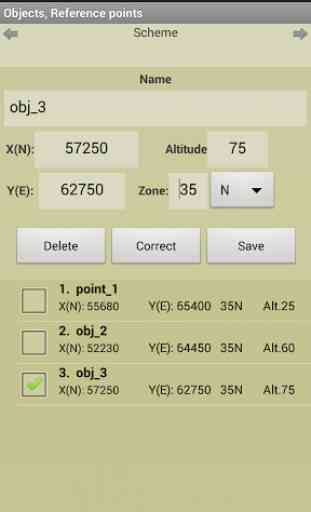
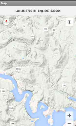
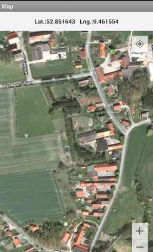
- minutes – seconds.GPS location in rectangular coordinates. Azimuth of the Sun, the Moon, the Polaris in specified time.Maintain a list of objects that may be used in which the tasks (150).Read / write and append data from a file. The data file may edit/prepare a text editor, transfer methods available.Map (topographic, satellite, hybrid) with markers points from the list (only with full coordinates). Grid on the map.When you touch the marker shows the number and name of the point.When you touch the map shown rectangular coordinates of the location.Maps are cached (accumulated) to work without a network.
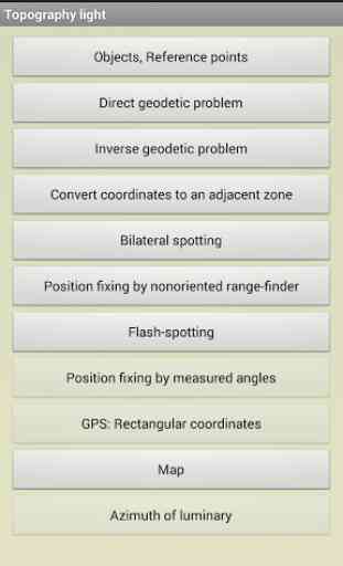
Tasks list: Direct geodetic problem; Inverse geodetic problem; Convert coordinates to an adjacent zone; Localizing with paired observation (readout from the base or directions);; Binding undirected rangefinder (range up to 2 known points); Binding by measured angles(between the left-middle and middle-right known points with anchor points); Binding according to GPS (geodetic and rectangular); Azimuth of luminary; Localizing with a stopwatch (with the air temperature); Map.
On the main menu screen to select
- The scale of thousandths (60-00/ 64-00)
- Color style
- The type of map (topographic, satellite, hybrid)
- Type of marker points on the map
- Grid on the map (no / 1km / 2 km )
- Save data to a file, read / write and append data from a file.
The program is distributed "as is". Its use
- discretion and responsibility of the user.
All tasks and all the features available in the full version.
Category : Travel & Local
Reviews (17)
Not working i can open only settings and subscribe
Good but the app not Easy to work
To use landconsolidation work.
Let's me chech it whether it is functional or not .
Somebody needs to explain to the developer that the X coordinate is the Easting and the Y coordinate is the Northing. Not the other way around!
Good for me, thanks
That is not what I am searching for
Not bad but bring new technology
Very cool
No instructions, not intuitive. I could get my lat-lon coordinates, and that's it. I couldn't do anything with those after I jotted them down. I need to find my WGS84 coordinates, and this app was absolutely no help. / So, after reading your reply to this, you admit that the free version of this app is, indeed, useless. You might want to include that info in the original description.
I'm trying to get an app that very useful for me for a long time and now I got it, thanks!
I hope this app, will help me
Try to make more suffisticated topographic apps
Just learning
Hateful
Used
I am working and in my fields u have to learn, to used the topography I did want to keep it as a guide? But my storage is limited ok.