FireMapper
BUSHFIRE SYMBOLSThis version contains bush firefighting symbols that are commonly used in Australia, USA & Canada with support for:
* National All Hazards Symbology Set
* USA Interagency Wildfire Point Symbols
* NZIC Symbols
GPS RECORDINGYou can record lines using the internal GPS.
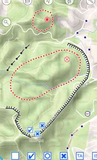
DRAW LINESQuickly draw lines on the map using your finger. Line types include:
- active/inactive fire
- proposed/completed control lines
- proposed/completed backburnsand more....
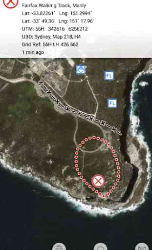
LOCATION FORMATS:-Latitude/Longitude (Decimal Degrees and Degree Minutes/Aviation)
- UTM Coordinates
- 1:25 000, 1:50 000 & 1:100 000 map sheet references
- UBD Map References (Sydney, Canberra, Adelaide, Perth)
FIND LOCATION
- search for locations using different coordinate formats (4 figure, 6 figure, 14 figure, lat/lng, utm and more)
OFFLINE SUPPORTMaps can be created offline without an internet connection. Map layers are cached for offline support
MULTIPLE MAP LAYERS:
- Standard
- Satellite/Hybrid
- Terrain/Topographic
- Australian Topographic
- New Zealand Topographic
- United States Topographic
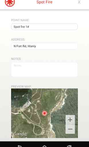
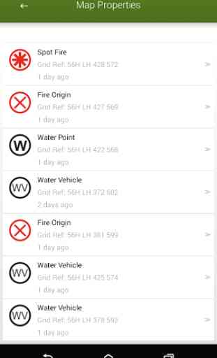
MAP EXPORT FORMATSMultiple points can be drawn on the map and exported in the same email. The map data can be exported as:
* GPX (suitable for ArcGIS, MapDesk and other popular GIS products)
* KML & KMZ (suitable for Google Maps & Google Earth)
* CSV (suitable for Microsoft Excel & Google Spreadsheets)
* JPG (suitable for viewing and printing)
- optional map legend and grid lines
MAP IMPORT FORMATS
* CSV and GPX is currently supported.
* KMZ and KML support to be added in future release.
GOOGLE DRIVE & DROPBOX SUPPORTYou can now share maps via Email, Google Drive, Dropbox and other file sharing apps.
Example:1. Create a map with FireMapper2. Click the 'Send Map As..' button and select 'Google Drive' & kml format.3. Share your map on Google Drive (users can view map on Google Maps).
Category : Tools
Reviews (12)
Love the App, one feature that wpuld be handy is to be able to say enter a bearing from a waypoint and give a distance. So that you could more easly locate smoke sightings etc. Would this be possible.
Update. OK mostly
Great app. (wrote a wordy review then managed to lose it). Will email directly.
Absolutely fantastic. Used it at many fires as on truck and in group vehical. Makes it so much easier to give good sitreps to Duty Officer
Getting better but difficult to see the total Fire size in hectares 9nce the perimeter is complete
Haven't used in anger, just testing. It wouldn't use the GPS until I manually gave it permission in app info. This happened on two different devices.
Doesn't scale well for incidents involving more than one or two crews. Difficult to share data and impossible to merge updated data between users. Doesn't import existing GIS data. Need to be able to copy maps so you can create an incident map from an existing pre-incident map.
Getting better with each update.Great support. Anyway you can add a key to exported maps?
Awesome, exports maps via Outlook. Any chance of having a GPS camera added?
Without being able to draw lines that represent fire front, dozerlines, completed line it is just a fancy map with no tactical use. Look forward to the updated version.
Would really like to be able to draw lines like ios version seeing the price is the same..
I love it. The range of options available and ease of use is outstanding. One suggestion would be to add a measuring tool for distance / area / possibly hieght.