FlyWise ILS
ATTENTION: Do not think to use this instrument in instrumental conditions !!!
* Connect the phone's sound to the headset, adjust the sound volume
* Select the desired airport
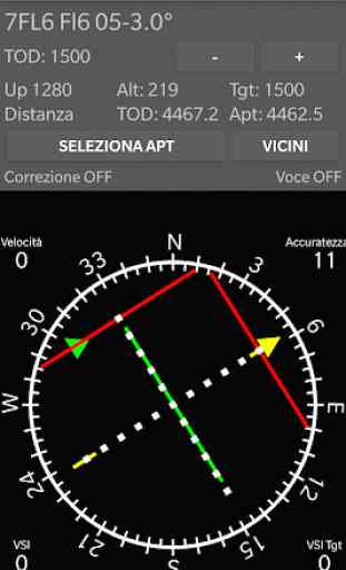
* Follow the "Green Arrow" of the instrument and turn to TOD. (67 degrees)
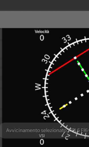
* The locator bar is "red" to indicate that the position is above the correct limit.
* The locator will become "yellow" once you are within range
* The "White arrow" indicates the direction of the touchdown point. (60 degrees)
* The "Yellow arrow" indicates the direction of the final approach route. (37 degrees)
* Descend to the Altitude "TOD" (upper part of the descent) using the altimeter of the aircraft as a reference
* At this point a GREEN glide bar will appear, which you must center
* As you approach the TOD, the Glide Path in "yellow" will drop
* The YELLOW glide ILS and the green glide of the TOD will merge into the TOD point
* After passing the TOD turn towards the approach indicated by a "yellow" arrow
* Start the descent following the ILS YELLOW glide
* The voice will announce: "50 up", "Center", "Down 100" etc ....
* Connect the phone's sound to the headset, adjust the sound volume
* Select the desired airport
* Follow the "Green Arrow" of the instrument and turn to TOD. (67 degrees)
* The locator bar is "red" to indicate that the position is above the correct limit.
* The locator will become "yellow" once you are within range
* The "White arrow" indicates the direction of the touchdown point. (60 degrees)
* The "Yellow arrow" indicates the direction of the final approach route. (37 degrees)
* Descend to the Altitude "TOD" (upper part of the descent) using the altimeter of the aircraft as a reference
* At this point a GREEN glide bar will appear, which you must center
* As you approach the TOD, the Glide Path in "yellow" will drop
* The YELLOW glide ILS and the green glide of the TOD will merge into the TOD point
* After passing the TOD turn towards the approach indicated by a "yellow" arrow
* Start the descent following the ILS YELLOW glide
* The voice will announce: "50 up", "Center", "Down 100" etc ....
Category : Maps & Navigation
Related searches