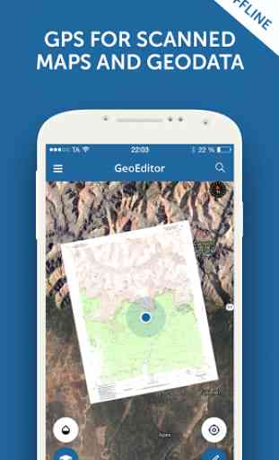
GeoEditor for MapTiler
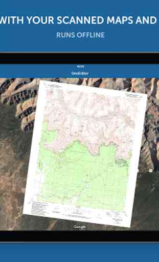
Display offline maps generated by MapTiler (http://www.maptiler.com).
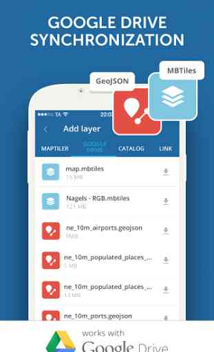
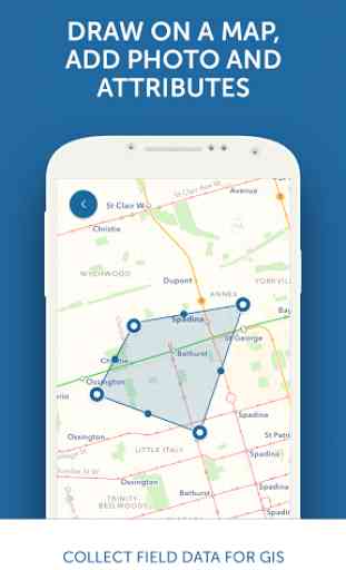
The app supports GeoJSON and MBTiles formats and synchronization via Google Drive for basic sharing of the data with other people! Perfect for mobile data collection for GIS and surveys.
It is easy to import scanned hiking maps, PDF maps, drone aerial imagery, nautical charts for sailing and navigation with a boat or a yacht, fishing maps, aeronautical charts for flight planning by pilots, parcels and city plans and other opendata from local government. Vector base maps are powered by OSM2VectorTiles. Maps can come from existing tile servers with TileJSON or XYZ tiles.
Supported geodata formats by MapTiler: GeoTIFF, TIFF, JPEG, ECW, SID / MrSID, NOAA KAP / BSB, DEM, OziExplorer OZI OZF2 & OZFX3, WebP, JP2, JPEG2000, GeoJP2, Erdas, Grass, Safe, Sentinel2, SRTM, NASA imagery, USGS map sheets, exports from ESRI ArcGIS, ArcSDE, etc.The GeoJSON can be converted from / to: ESRI ShapeFile, DXF, DWG, GPX, CSV and KML.
Contact us if you want to use the functionality from this app in a rebranded app for your customers, for your business use-case or for presenting your own maps. We can provide the source code and assist with customization.
Category : Travel & Local
Reviews (14)
Excellent ! See for a wide variety of maps in the catalogue section . Great app for map explorers .
Probably useful if you are familiar with map apps. I just want to view a geoTIF on my phone. Can't work out how to do it in this app.
Made in app purchase on June 2018. But, now it says, I'm using free version and asking me to upgrade. Earlier used gmail integration. Now not working. Please rectify both of them.
Good but...not so good. I don't get why raster are resampled. My map is blur and almost unusable!
Nice look but could not find any options to add maps / layers stored on my device so not helpful for me.
sorry i can't give less then that. poor app crashing and reverse button working as exit button.
Says you can open mbtiles files but there is no way to look for them in the device storage.
Very difficult to use
I love this map tool
Worth trying.
This is an awesome little app! The MapTiler is free on the web, so you can georeference whatever you need, and it imports beautifully. You do need to be able to store the file in the cloud long enough to download it to the app. Look forward to it being able to access storage directly and entirely without the Cloud.
No way to use local files. Why on earth should I upload to my Google drive and download where I could copy ....
Perfect way to preview MBTiles offline and to make geometry on the map
Description says "Import scanned ..." and mentions some formats. It turns out that except for mbtiles, all the listed and implied formats are imported into the desktop software for conversion, and then the output can be used in this app. Should be clearer. I got excited when I recognized the developer, "Klokan," from their wonderful "Old Maps" app, which includes the USGS Historical Topo Map Collection. I was hoping that if they could pull and show the USGS topo GeoTiffs and GeoPDFs there, they could do that here. But I guess that then it wouldn't be a MapTiler app. I'm retired. I don't do desktops anymore. Maybe Klokan will someday bring together the data access of Old Maps, and some tools? All I want is to trace from old topos to GPX, without having to buy an iPad. Two stars instead of one, because it looks like it probably does what it is intended to do.