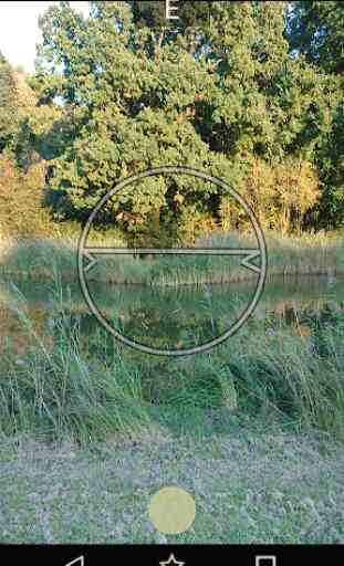
GeoLabel - GPS Photo Surveys for Android
The location is also stored in the image metadata in a standard format so if you need to use GeoLabel's output with any mapping tools they should work together automatically.
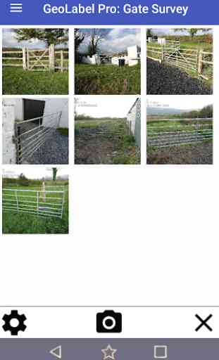
GeoLabel is free to use with no advertising but limited to a maximum of five surveys ( there is no limit to how many images can be in a survey ) and images are watermarked. There is a very inexpensive upgrade that allows you to create unlimited surveys and removes the watermark, if you find the app useful please consider paying for this upgrade.
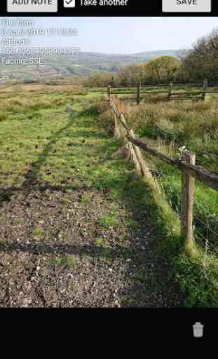
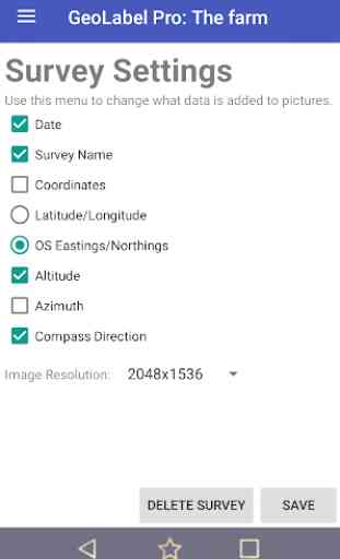
Data that can be added to image labels: Survey name, Date and time, Coordinates, Altitude, Azimuth and Compass Direction. The accuracy of location data depends on your device. GPS co-ordinates can be stored as Latitude/Longitude or Ordnance Survey Eastings/Northings ( National Grid Reference or NGR ) if you have a different co-ordinate system you would like us to add, get in touch.
In addition to people creating surveys, working with GIS, needing to label images as they take them and anybody looking for something that works like Theodolite, GeoLabel is useful to archaeologists, geologists, farmers and agricultural contractors, rights of way specialists and anyone wanting to report problems on rights of way, field engineers, landscape gardeners, site contractors, ecologists, countryside rangers, botanists and field scientists - the fact is that anybody who works outdoors or is engaged in field work will find GeoLabel a valuable part of their toolkit.
Category : Tools
Reviews (10)
Please add UTM coordinate system. Would be great to be able to take photos in landscape. Also noticed that when checking the location of the photo's there is a 1/2 mile difference from where the photo was taken and where the pin is in Google maps. But will be a very useful app once the bugs are worked out.
Hi. 5 stars because i like your app. Now the issues: Can you make coordinates with 6 decimal places. Why 3 ? Why truncate the satellite that much ? Secondly, you need a setting which can correct the gps altitude (i cannot understand why Android does not have this by default). Altitude info is useless without this correction. All phones i have ever owned needed correction. Only my own web apps seem to have this capability (as if i could possibly check all the apps on earth !?!?).
I even bought the 'premium' version and it just gives the red thinking circle of death. I found out originally that my GPS accuracy was low so I fixed that issue and it worked once and then back to the red thinking circle of death. I can wait five minutes for it to "think about" taking the photo but nope...nothing. It provides me no way to troubleshoot to see why it's a problem (GPS not on? No cell service?) or what the problem could be.
So difficult to take a photo sometimes... Just shows loading sign nonstop without storing phone. If I keep close and reopen app, I can take a single photo after a few attempts but I can never take 2 photos in a row ever with app glitching out.
Great little survey tool. Location in OS nat grid ref not just long/lat is really appreciated. Grouping photos by survey super useful for organising work and stamping survey name saves a lot of time with repeat labels. Like being able to add discrete notes by photo too.
All was good until the 18th of December. After that all pictures taken have resolution 1072 x 1920. It doesn't matter if you try to change the resolution in the settings. Please fix it.
This app is bad. Even when I'm in town (LTE) it can't take/label a photos. Just the red ring and then poof, no photo.
Great app. About time Android had a tool for detailed geo labelling of survey photos. Good work.
the best app I've used in a long time to record surveys :) thank you
* Edit: was able get it to work by installing autosync premium for onedrive. Its $10 but now I have what I wanted. Seems nice and simple which is most of what I was looking for, but I can't automatically back up new surveys with Onedrive. You can not automatically sync files under the GeoLabel folder and instead have to sync every survey folder individually. This can get tedious quickly. If your only lightly using the app or not doing many surveys then its nice and simple.