GisPoint
The program is based on KML data that is loaded locally on mobile phones to collect data for GIS. Application supports Opengis Kml standarts. Kml data can be supplied by Google Earth.
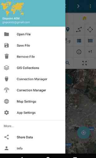
GisPoint application features:
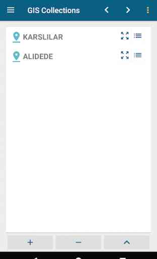
- Layer support (Gis Collections ).
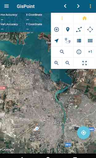
- Google satellite view, google street view, google hybrid view and empty map view support.
- Mapbox, Openstreet
- Offline tiles
- Load Kml(OpenGis standarts)
- Load Kmz (Application reads only doc.kml file).
- Load coordinate file (Text file).
- Save Kml, Dxf (2009 ver) ve Txt (coordinate file) .Saves only works.
- Coordinate Editor. Supports multi add, edit and delete point coordinates .
- Measure or get my locations coordinates.
- Read coordinates from map..
- Measure length.
- Calculate area by click on map.
- Calculate area by single click (Needs Kml data).
- Add single coordinate.
- Navigate.
- Find parcel (Needs Kml data).
- Get parcel info (Needs Kml data).
- Find location form adress, adress form location.
- Save and open layer .
- Zoom to active layer.
- Share Kml data.
- Save my places.
- Help menu.
- Supported datum or coordinate sytems: ITRF96 3 ve 6 degree Ed50 3 degree, UTM 6 degree, Latitude-longitude (WGS84).
GisPoint application features:
- Layer support (Gis Collections ).
- Google satellite view, google street view, google hybrid view and empty map view support.
- Mapbox, Openstreet
- Offline tiles
- Load Kml(OpenGis standarts)
- Load Kmz (Application reads only doc.kml file).
- Load coordinate file (Text file).
- Save Kml, Dxf (2009 ver) ve Txt (coordinate file) .Saves only works.
- Coordinate Editor. Supports multi add, edit and delete point coordinates .
- Measure or get my locations coordinates.
- Read coordinates from map..
- Measure length.
- Calculate area by click on map.
- Calculate area by single click (Needs Kml data).
- Add single coordinate.
- Navigate.
- Find parcel (Needs Kml data).
- Get parcel info (Needs Kml data).
- Find location form adress, adress form location.
- Save and open layer .
- Zoom to active layer.
- Share Kml data.
- Save my places.
- Help menu.
- Supported datum or coordinate sytems: ITRF96 3 ve 6 degree Ed50 3 degree, UTM 6 degree, Latitude-longitude (WGS84).
Category : Maps & Navigation
Related searches