gps bluetooth
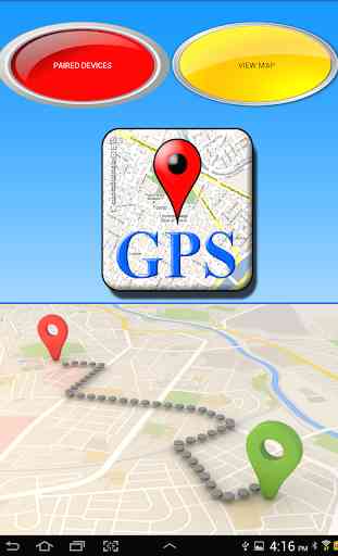
The Bluetooth GPS application allows you to connect a GPS remotely via Bluetooth. The remote GPS can be controlled through a micro controlled system Arduino, Raspberry, PIC or any other system. GPS Bluetooth has a menu with two icons: PAIRED DEVICES and VIEW MAP. Using the VIEW MAP icon, we can obtain the GPS coordinates provided by the internal GPS of our device.
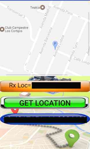
When obtaining the internal coordinates through GET LOCATION icon we can visualize the latitude and longitude of our geographic location and visualize our position in the geographical map. This utility is very important to use our device as a GPS that provides our geographic coordinates.
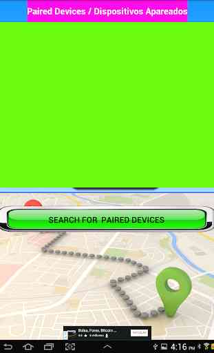
With PAIRED DEVICES icon we can connect to the external GPS through a Bluetooth connection. The external GPS system can be connected to a micro controlled Arduino, Raspberry or PIC system. The micro-controlled system must transmit to our device the satellite GPS coordinates in the following format:
"LATITUDE LONGITUDE"
The remote GPS system can be located in a robot, vehicle, airplane, etc. To the extent that the remote system transmits the coordinates to our device is drawn in the geographical map the route that is made with different markers. The start marker is identified with the letter "S" and the final marker with the letter "F". Between this markers will generate different markers identified with numbers. All satellite coordinates transmitted by the external GPS are automatically stored in a file in the internal SD of our device. The file containing all the satellite coordinates received is called "ruta.txt". This file can be used to be converted into a GPX or KML file on page like;
http://www.gpsvisualizer.com/map_input?form=googleearth
The obtained GPX or KML file is used in Google Map or similar pages to trace the paths indicated by the stored satellite coordinates. The procedure to do this process can be observed in the You Tube video of the application or in a tutorial located in the page of the developer.
The route file is generated automatically, and all coordinates are added. If you want to delete the file of the route you can delete it with the icon "DELETE PATH FILE" so that a new one is generated.
When obtaining the internal coordinates through GET LOCATION icon we can visualize the latitude and longitude of our geographic location and visualize our position in the geographical map. This utility is very important to use our device as a GPS that provides our geographic coordinates.
With PAIRED DEVICES icon we can connect to the external GPS through a Bluetooth connection. The external GPS system can be connected to a micro controlled Arduino, Raspberry or PIC system. The micro-controlled system must transmit to our device the satellite GPS coordinates in the following format:
"LATITUDE LONGITUDE"
The remote GPS system can be located in a robot, vehicle, airplane, etc. To the extent that the remote system transmits the coordinates to our device is drawn in the geographical map the route that is made with different markers. The start marker is identified with the letter "S" and the final marker with the letter "F". Between this markers will generate different markers identified with numbers. All satellite coordinates transmitted by the external GPS are automatically stored in a file in the internal SD of our device. The file containing all the satellite coordinates received is called "ruta.txt". This file can be used to be converted into a GPX or KML file on page like;
http://www.gpsvisualizer.com/map_input?form=googleearth
The obtained GPX or KML file is used in Google Map or similar pages to trace the paths indicated by the stored satellite coordinates. The procedure to do this process can be observed in the You Tube video of the application or in a tutorial located in the page of the developer.
The route file is generated automatically, and all coordinates are added. If you want to delete the file of the route you can delete it with the icon "DELETE PATH FILE" so that a new one is generated.
Category : Education
Related searches
Reviews (2)
Sha. A.
Feb 20, 2020
Trash app. Don't bother.
Don't waste your time, doesn't work and nothing but nonstop ads!!!