GPS Grid Reference DEMO

Now with Android Wear support, giving important information on your wrist.
User testimonial:"Brilliant App for Military & Emergency Personnel With support for most major grid reference systems, a built-in compass and My Tracks integration, this application is perfect for military or emergency personnel, in addition to anyone whom spends large amounts of time hiking, bush-walking, etc... Extremely accurate and quick to lock-in a location by satellite"
Why not try out the free demo first?
Many GPS & Compass features, combines with various OFFLINE maps (UK OS map, USGS, OSM, Mapnik, Topo & Cycle and more!).
Support GPX (GPS Exchange Format) file import. Simply use any file manager and select a GPX file to import.
Supported coordinates: OS grid reference, Tetrad, MGRS (WGS84), MGRS (WGS84), MGRS(NAD27), WGS84, OSGB86, Maidenhead, DMS, UTM, USNG and CH1903 Swiss Grid.
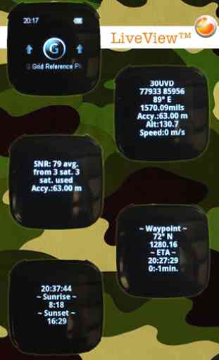
- LiveView support
- display coordinate information, satellite information, ETA and time information.
- SE LiveView Beta (display coordinate information (right menu), satellite information (left menu), ETA (down menu) and time information (up menu). Any problems please email [email protected].
* Track Recording via My Tracks. Record your tracks, see live stats export tracks and share with friends via Google or GPX, KML, CSV and TCX file.
*
* Visit website www.gpsgridreference.com, checkout full user guide and videos **
**Any issues or feature requests please email me**
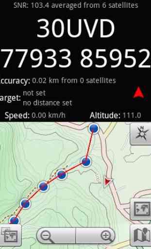
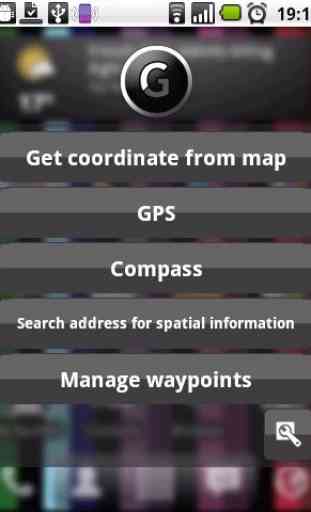
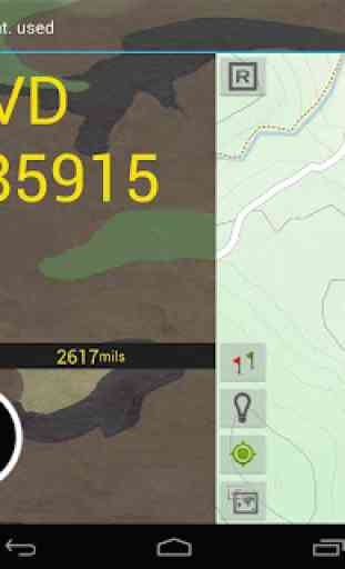
GPS mode shows coordinates from GPS, offline maps with switchable full screen mode, compass, GPS status and overlay the waypoints over the maps to get distance, bearing and ETA.GPS mode now equipped dual screen (just swipe top screen) with digital compass and mils, ETA time and minutes, sunrise and sunset time
Manage waypoints mode allows you to create set of waypoints, using maps or manually enter coordinates and use it in GPS mode.
Get Coordinate from Map mode; simple way to get and share various types of coordinates from maps
Compass mode show analogue and digital mode with mils.
Search address for spatial information mode provides ability to search and obtain coordinates for any address and postcode anywhere in the world.
extends:com.sonyericsson.extras.liveview
Smart Connect extension for SmartWatch 2
Category : Travel & Local

Reviews (21)
Was hoping on using my watch when geocaching to save battery. However nothing shows up on my watch. Im in map mode but nothing.
Why would anyone buy the full version if the trial doesn't work? Freezes after a few seconds
Uninstalled since doesn’t work
Very usefull to us. Thnks
Works very accurately.
This app works so well, nothing comes close get Mgrs from addresses maps or your position, plot points and start ruckin. Use it for current operational requirements range planning and much more Using this app for planing will be rough though, the goto feature does not work on any android device I own, maybe I'm messing it up but it always end up in the ocean same place no matter the grid
Don't bother wasting your time. It's a free trial that doesn't give you time to trial it! 10 seconds and your out! Don't think I will bother wasting any more time on buying the full app.
Not enough time to evaluate in the demo version, so I won't be getting the full version.
Looked like a good app but it's VERY complex and the learning curve is high. The demo gives you 60 seconds with each function which is no where near enough time to get me interested in keeping the app but is just long enough to confuse.
Trial version works well (droid global), shows enough functionality to make purchase of full version appealing. Note: if you don't have a REAL need for this type and amount of data, you're wasting your money. Fortunately I do. Looking forward to it.
Wish the free version actually let you see what it can do cos I think it might be what I want but can't tell so not gonna risk buying.
I love its potential. Unfortunately, Android Market does not allow AmEx card to be used for non-USD to purchase paid app.
Free version is crippled - only gives grid refs for 1 minute at a time.
Great app, wish it was free but free version works well.
Awesome app, wish I didn't have to pay for full features though.
Would help if when u click a map pin or crosshairs showed you exactly where you had touched the screen. Otherwise accuracy is difficult. Nice start
Good idea, needs a TON of work.
One minute seriously that is bullshit
Nice idea but buggy!
Thanks
It couldn't get a fix on me, and it didn't give OS ref even when selected.