GPSLogger II - AIO

- all for free & without in app advertisements
GPSLogger II is a pretty straightforward application that can record your GPS based location over the time. Initially developed for the BlackBerry platform (started 2009) the functionality have grown constantly over the time. Even this is the first release for Android you can expect an package that is suitable for all kind of activities, include outdoor navigation, geo-caching or an easy to use car finder.
Beside the actual position (in WGS84) the application will record the time, speed, heading/course, altitude, accuracy (of the signal), number of satellites and (if enabled) the raw NMEA-data.
GPSLogger comes with plenty of settings which should allow you to adjust the application to your personal likings, starting with the selection between imperial, metric or nautical units or different location formats [DD.MM'ss.ms", DD.MMMMM, UTM (+Zone), MGRS or raw mode]. The speed can be toggled between km/h or 'Minutes per KM' (of course also as mph and Minutes per Mile).
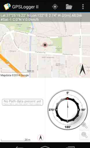
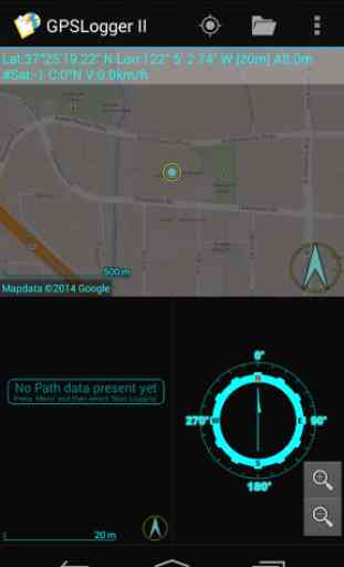
There are ten different views (up to three of them can be displayed simultaneously) Each view have a specific use case and allows you to adjust the display information to your personal needs. You simply can switch between the different views by swiping left or right.
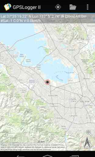
- OpenMapData ViewCurrently the following OpenMapData providers are supported: MapQuest OSM, MapQuest Open Aerial, Bing Maps|Satellite|Hybrid, esri World Street Map, esri World Topographic Map, OpenCycleMap, Outdoor (by OCM) and Landscape (by OCM)
- also you can specify a custom tile-server URL, so you could just add your preferred local map data provider (please check the corresponding tile server usage policy).
Please note, that GPSLogger will request the map data only once
- so it can work completely OFFLINE once that map data has been stored on your device (an additional free DesktopTool is also available).
- Path ViewWhen you have no data connection (or have configured GPSLogger that no data should be transferred) the path view is a simply plot of your current logging path (or the navigation path
- or the path data that you have loaded in the background)
- Direction ViewBy default your logging starting point will be the initial direction record. The Direction view points you into the direction of this navigation location and display all kind of additional information like the estimated time of arrival (based on your current speed/average speed), the relative speed to the target location (very useful for sailing) and of course the course to the target location.
When you are using GPSLogger for outdoor navigation the direction record will change dynamically based on your travelling progress and your specified outdoor navigation settings.
- Speed View, Elevation View, Compass ViewSimple plot of your Speed/Elevation values over time and a Compass
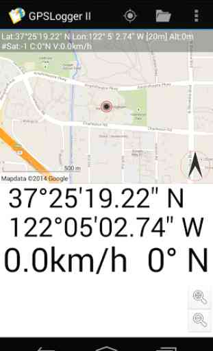
- GPS CoreData ViewDisplaying the location and the current speed and course in the largest possible font on your device
The remaining other 3 views Navigation Direction, Navigation GPS Core Data and the Navigation Speed can be very useful when you make use of the extended outdoor navigation functionality
- actually I have implemented them for my personal usage when I am riding with the MTB. See http://www.emacberry.com/gpsl/nav/nav002.html for details.
Core Functions:======================o GPSLoggero Speedometero CarFinder / Bring me Homeo Outdoor Navigationo GeoCaching and Waypoint Managemento AutoEmergency Alerto Import and Export of KML or GPXo 100% OFFLINE
REQUIREMENTS======================o An Android® device with a build in GPS Antenna (or a active & already paired Bluethooth GPS-Puck)o Use GPSLogger II outdoors
- The reception of the GPS signal inside a building can be very bad or even not available at all.o Permission
Feedback & Support via our Forum @ http://forum.emacberry.com/viewforum.php?f=198
Category : Travel & Local

Reviews (13)
V 2.0.0.214 bug? I cannot change/delete my existing profiles; neither create a new profile.
Tries to do too much. Complicated ui, hard to understand outside in bright sunlight.
Fantastic APP ! Much more accurate than latest Garmin units, Well done !
I can't find the export to email option.
Lightweight and stable app. I have it on both my Blackberry Q10 and android. Will test more outdoor in the woods.
Its great for hiking or hunting. Even with no cell service, and it has NO ADS!
Used this app all the time on my BlackBerry. Very feature rich!
ThankYou
This is brill a big thanks for writing this keep up the good work
Use it since BB version, 5 star!
Waiting for GPS to initialize & No data are always display in the app !!
Can't save to SD
Fantastic app. I've used it for years, and the developer is responsive when issues come up. He has made so many improvements, I don't use the app nearly to its fullest capabilities.