Green Tracks
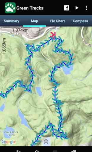
GTs support Mapsforge and MBtiles offline map. It's helpful in climbing and hiking.
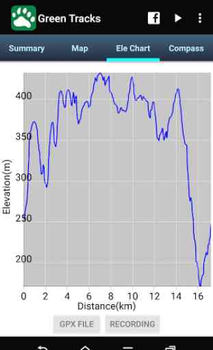
Support hgt file to improve elevation accuracy. You can extract hgt files to the specified path by Global Settings.
You can download hgt files from http://www.viewfinderpanoramas.org/Coverage%20map%20viewfinderpanoramas_org3.htm
You can download offline map (.map format) fromhttp://www.openandromaps.org/en/downloadshttp://download.mapsforge.org/maps/
If you like this app, help me to translate into your language please. you can contact me by email. Thank you.
Category : Travel & Local
Reviews (19)
This app is amazing!! Imagine having an offline gps enabled map of every hiking trail in your state? This makes it possible. It is tricky to set up so make sure you install the map packs carefully and follow directions
It seems nice until you need to use it. I have been trying to find instructions for this app and can't find any. It's so annoying. By trial and error and touching every button, I was finally able to do a route. It would be nice if there was a button for "start hike" or "start trip" but there isn't any and no you tube video either.
I have been using the app for several years and have the add-free version, all this time with no issues but recently the maps won't show and all I get is white tiles with message : Contact[[User:TheDj]] if you want to mantain OSMdb and/or wmflabs' OSM tiles erver.
Crashes after I try to open 200+MB .gpx file. Offline maps/navigation is very important in an area where there is no signal.
Great. Just great. I love the offline map and ability to follow a GPX route. 10/10.
Not new user friendly, seemed to be good in the beginning but at the end of the day, I couldn't see any trails on the map even after downloading several states for offline use. Thought downloading offline maps would help, it didn't.
Could not download any maps, no info on how to set it up, no trails showing anywhere on default install. Might be useful if downloading maps or required "elevate" app worked. Just cycles back to same download page and map buttons do nothing. Any advice welcome before I uninstall.
I have to echo an earlier comment. Seems like a good app, but NO INFO on how to set it up or get started using it. Only some ridiculous abbreviations on other sites reviewing it that make no sense to anyone who's not an app developer. Come on, post some screen shots or something - MAKE IT SIMPLE. Don't make your customers hunt and search and try and fail just to get it working.
Great app, very functional. Perfect for outdoor adventures without cell service. The UI is a little outdated, but it gets the job done.
Nice app, good aid to get a gps fix and can import gpx files, i would study the app before relying on it! A the end of the day there is no substitute for a map and compass. Dont know how long it will stay free though
Maybe I'm missing something - but there's no info on how to use the app or how to download and install maps. There are no trails marked on the maps, just google maps.
I truely rely on it to safely hike in the mountain. It never fail me.
Very cool app super handy and precise use it all the, time, even if you turn of the power saving, is quite easy on the battery, well done.
I download offline maps 4 Carolina but when I select the map file it took awhile to show or upload the map. But it is working. It just moves a little slow on my phone
Looks Good, but not yet tested on the road. Don't see a way to download an area. When using OpenCycleMap, how to avoid the "API Key Required" water mark ?
Great app!!! The offline option specially on the mountains with no signal works fine and is unbelievable helpful!
Great offline maps. Can maps stored on SD card? Would be great if support explore trails and download like in viewRanger or alltrails app
Tested this app on my regular walk and it only recorded 0.2km so I uninstalled it. Maps look great but it doesn't work!
possibly the best hiking navigation tool (out of these free to use - I did not use subscription maps). It requires some basic computer/file management skills to get maps required. It is not as flashy and polished as other apps but works well for my needs.