Hiking Map Slovakia
Application features:
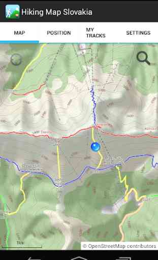
- shows your current position on the map,
- searches locations on the map (requires internet connection),
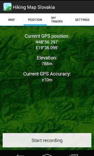
- shows current coordinates, elevation, and accuracy of GPS,
- records your track (also while running in background),
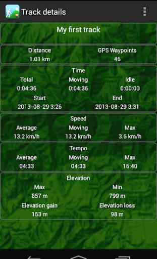
- calculates your recorded track statistics (distance covered, duration, elevation gain, speed, ...),
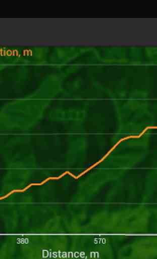
- renders elevation profiles,
- exports your recorded track into GPX or KML file (file is either saved on memory card or sent by email),
- adjusts GPS accuracy (lower accuracy settings extend the battery life).
The map in this application was generated using data from the OpenStreetMaps project. This data is licensed under (c) OpenStreetMap contributors. The map tiles and design is licensed under (c) Daniel Tekel.]
Important warning: Do not substitute the application map for the official hiking maps in your area. The application map currently covers approximately 90% of the existing trails. The author of this application assumes no responsibility for any map inaccuracies.
Category : Travel & Local
Reviews (8)
Not very usable - the zoom is very limited, you can zoom out only a tiny bit, then have to scroll through half of Slovakia manually still in a very detailed zoom. Search doesn't work good - "Sivý vrch" was not found. The fact that the app has typoes also shows that it was probably botched together quickly. Needs a lot of improvement before it's worth using / downloading. Also requires around 230MB of space.
This app only includes a relatively old version of OpenStreet maps, which covers only a small fraction of marked trails. Coupled with very quirky zooming and complete lack of other features, this is most likely not the app you're looking for.
I suggest adding bigger zoom on the map and showing the direction.
But stores map (500MB) in internal storage...
I need zoom in Maps. I have fullhd display and text is very small. :-(
Cannot pin a random point on map and say go, only for people that know the hill names in Slovakia
On LG G3 unusable, missing usable zoom functionality and planning of routes.
This app is good as replacement for classic paper map but not as modern app with GPS- accurate is limited because you can't use zoom.