Input
Category : Maps & Navigation
Reviews (30)
Really nice interface and features. I'm having just one issue at the moment, when typing in information longer than the box I can't see what I'm typing because it doesn't follow what was last typed. I can only see what I have typed if I scroll to the right manually, is there a fix for this?
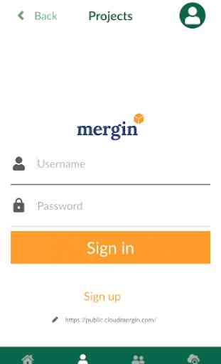
The app is simple and easy to understand, that's great. And it's free, but the description promises export and interoperability with qgis. This seems to ONLY be possible via the open source online mergin service. I expect the app itself to be able to export the field data without synchronizing it through a service. ( My apologies to the team for assuming that mergin was proprietary, and thanks for your generosity to release it open source! )
Great field survey app linked to a Cloud through Mergin. As a peatland restoration programme we conduct field surveys in the uplands of Autumn and Winter in the UK. We are quite frequently exposed to extreme weather conditions and gloves are required. With a stylus, I note that you can double tap the screen to zoom in, however this often highlights a layer and is sometimes intermittent. It would be fantastic if you could add in a zoom in/out function on the display. Thanks, Ollie
Great ap very easy to use and install and compatible with many GIS systems. I am using it to survey and map extent of invasive species across a catchment. Often chatting to landowners at the same time and have been able to map and chat simultaneously. I contacted Lutra regarding licencing and had a positive response within the hour. Excellent customer service. One star lost due to occasional stability issue, always resolved by restarting the ap without any data loss.
Please add feature to measure distance between 2 free points, and if possible to measure area of freely created polygon. Thanks for making this very useful app and make it free!
Brilliant app but I am experiencing quite a lot of crashes across two devices (moreso on one) and one bug seems to corrupt the projects I try to upload which means for the moment, its not reliable enough for me to trust with data.
Best field software we've used in a while. Easy to use, easy to maintain, not bulky on the phone, ports with QGIS very well, and has a free user level that is accessible to all!
So far I really like the app for its simplicity and data sync facility. One thing Id like to know is when configuring a project in QGIS, is it possible to utilise ploygons or lines in the geometry type. I tried selecting polygons but it still came out as points.
As one of the QGIS desktop users, I am always grateful for the contribution of Lutra Consulting. Input is also really nice! I completed 100% of the Korean translation of this app on Transifex today! Now you can add ko as well. :)
Really good app that does exactly wat we need it to and sync data between and within our field teams and to the office.
This product is great on IOS and now that it is on android as well, this expands our capabilities. Outstanding support (Saber), just outstanding.
The App is very accurate and is very easy to use. Their customer service is very commendable. Thank you
Very stable and usable for field works. The app can open and visualize GİS data faster compared to other GİS apps.
Makes an ideal mobile companion to Qgis. Takes the pain out of field data synchronization.
Hello. I'm having issues with the decimal values in androids devices. It removes the decimal point...please advise.
A great app, quite easy to use and great customer support. Would recommend.
Nice app, would really be outstanding, with the introduction of measurements tools and snapping geometry capabilities
Incredibly useful application, Lutraconsulting was also very fast to respond to queries and helped solve data collection challenges
Perfect surveying application. Easy to use and all functionality you need
Hello please make possible uploading to another cloud services. That would be awesome for this app. Thank you
Great app. All the features we needed to take our QGIS projects with us into the field.
Simple to set up and use, particularly with QGIS.
Cant remember password, no way to request a reset Thanks devs will give a try
What I was looking for. Great...
Easy to use and support team are best
Need to add map rotation ability ,up
Finally an app that complements QGIS as it should. Easy to use.
Great app and easy to use
for some reason this stuff was chinese and I have no damn clue how to change that edit: I was being a dummy, cheers
Why is the app half in Japanese and half in English? Even with a basic knowledge of Chinese and Japanese I wasn't able to change the language in the app. Not usable.