Kapalo
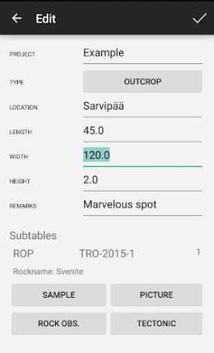
This is the mobile version of the bedrock data capture system for outcrops and boulders (Kapalo) of the Geological Survey of Finland (GTK). Application uses a simplified version of the same data structure than the full version used in ArcMap environment. Certain domain lists of the mobile version have been shortened from the full ones. The mobile version allows the storage of the following five point types: bedrock observation, rock observation, structural observation, sample and picture. Out of these, the bedrock observation point is at the highest hierarchical level and the other four are linked to it in one to many relationship. Observation, sample and picture file naming are done according to GTK’s convention, but these can be manually edited. Data is stored in a .sqlite database named “kapalo.sqlite” in the root folder of the used apparatus.
** Features **
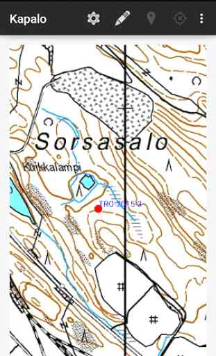
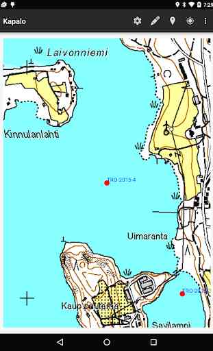
- Offline .tpk basemaps
- Offline mode with or without GPS for longer battery life
- Datamodel fully compatible with GTK's internal bedrock orbservation datamodel
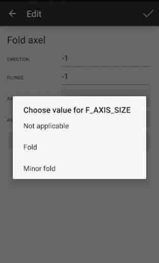
- Store, capture and edit geological data in ArcGis 10.3+ compatible database (Observation, Rock observation point, Linear and planar structures, Outcrop pictures, Samples and Mineral data)
- English user interface and classifications
- Comprehensive geological documentation available at
http://gtkdata.gtk.fi/mobiili/
Mapping API provided by ESRI Arcgis runtime for Android
** Features **
- Offline .tpk basemaps
- Offline mode with or without GPS for longer battery life
- Datamodel fully compatible with GTK's internal bedrock orbservation datamodel
- Store, capture and edit geological data in ArcGis 10.3+ compatible database (Observation, Rock observation point, Linear and planar structures, Outcrop pictures, Samples and Mineral data)
- English user interface and classifications
- Comprehensive geological documentation available at
http://gtkdata.gtk.fi/mobiili/
Mapping API provided by ESRI Arcgis runtime for Android
Category : Tools
Related searches