Lageplan
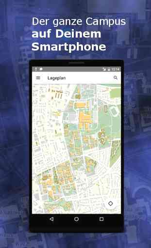
„Lageplan“ is the official Android version of the spatial information system GRAS_Geo at the University of Göttingen. This app helps you to find your way around the campus!
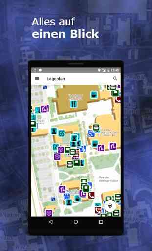
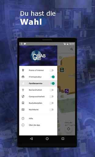
If you are confused by too many symbols on the campus map, just activate the information layers you are really interested in. You have the choice:
• Points of Interest (examination offices, information desks…)• IT Infrastructure (printers, computers)• Family Service (parent-child rooms, play areas…)• Accessibility (automatic doors, elevators…)• Campus Security (first-aid rooms, intercom systems…)• Bus stops in the campus area
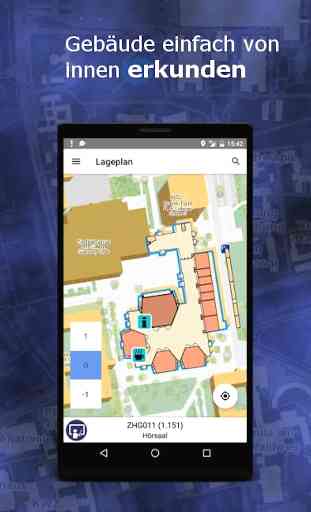
Perhaps you always wanted to explore a university building without so much as moving your finger? Tap on a building and have a look at the floor plan for each level. If you would like to know what is happening in your institute while you still relax at home, select a lecture hall or seminar room and you will get a list of events that take place in this room today.
Your new seminar starts tomorrow, but you have no idea where to find it? Just search for the room number and the room will be displayed on the map. You can also search for combinations such as “lecture hall geography” to find all lecture halls at the Institute of Geography or “printer physics” to find printers in the Faculty of Physics.
Or maybe you already got completely lost on the way to a university building? Here is the solution: Use the app to find your current position, check the integrated compass and don’t let anybody notice that you missed the building by two kilometers!
Do you still have questions? Or is there a technical problem with this app? Then please contact us at [email protected]!
If you are confused by too many symbols on the campus map, just activate the information layers you are really interested in. You have the choice:
• Points of Interest (examination offices, information desks…)• IT Infrastructure (printers, computers)• Family Service (parent-child rooms, play areas…)• Accessibility (automatic doors, elevators…)• Campus Security (first-aid rooms, intercom systems…)• Bus stops in the campus area
Perhaps you always wanted to explore a university building without so much as moving your finger? Tap on a building and have a look at the floor plan for each level. If you would like to know what is happening in your institute while you still relax at home, select a lecture hall or seminar room and you will get a list of events that take place in this room today.
Your new seminar starts tomorrow, but you have no idea where to find it? Just search for the room number and the room will be displayed on the map. You can also search for combinations such as “lecture hall geography” to find all lecture halls at the Institute of Geography or “printer physics” to find printers in the Faculty of Physics.
Or maybe you already got completely lost on the way to a university building? Here is the solution: Use the app to find your current position, check the integrated compass and don’t let anybody notice that you missed the building by two kilometers!
Do you still have questions? Or is there a technical problem with this app? Then please contact us at [email protected]!
Category : Travel & Local
Related searches