Maastokartat
• Show maps from online map services
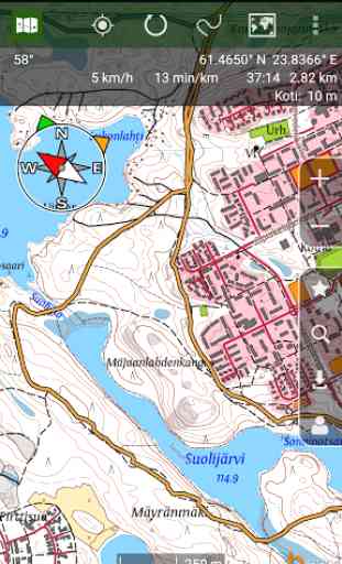
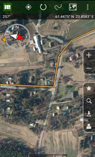
• Included maps: Finland topographic maps, aerial photos and nautical charts. Norway and Estonia topographic maps.
• Compass, rotate map based on heading
• Show current location on map, keep map centered
• Coordinate formats: WGS84, ETRS-TM35FIN, YKJ, KKJ and MGRS
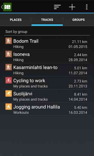
• Save favorite places
• Group places and tracks
• Backup to Google Drive
• Direction and distance to selected destination
• Import and export places and tracks in GPX format
• Place name searchAdditional paid features:
• Offline maps, download maps for offline use from areas of your choice
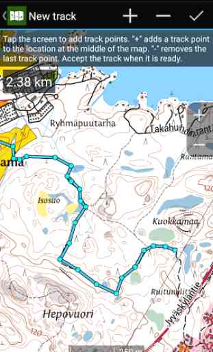
• Track recording and track planning, save tracks and show them on map
• Location sharing between users, track location of other users on map
Category : Maps & Navigation
Reviews (24)
Excellent usability, freely usable maps, accurate and fast. 👌 Used in military exercises, nature hikes and daily commuting. I can recommend this application for anyone with a bit of patience for reading the manual to gain full leverage of all the features.
Works like charm. I would like to have more functionality (moose hunting point of view) like group handling utilizing phonebook, places on the map so they could be grouped, created and selected quickly and to point a member to the each place, or even to set group members to places by lottery.
Perfect for navigating in the great outdoors!
First impression very nice, but nautical charts do not load on my trusty Galaxy Note 8.0 with Android 4.1.2. Hope this can be fixed before the boating season.
Great detailed maps. I really like the option to add favourite place markers. Highly recommended.
Like the option of boat navigation map, very useful for kayaking then changing to normal map for land navigation.
Very accurate map in details. Wortwhile even with the complimentary features only.
Maps are outadated. At least three years old and probably more. But still nice for the free app.
Great app! Obviously wishing more features were available but works well as free version!
Very good app, with lot of information for hiking or just spending some time in the nature
super map application for boating, snowmobile maps for finland, sweden and norway would be nice
great help in boat trips when other maps are not available
Super handy app to have along in the forest.
The best and most accurate map of Finland.
The best Topo maps for Finland!!
Very accurate and helpful.
Best terrain map aps I have, definitely!
Very useful and free of charge
Just what you need for day hiking trips
Fluent and comprehensive.
What happened to "Show in Google Maps"????
It's not the clearest to use
Stupid update nitifications covering the map
Trails visible only quite a bit zoomed-in (compare with Karttaselain). I can't measure >1km distances because the trails disappear at that zoom level. Also, when measuring smaller distances with two fingers (great innovation btw), the number is obscured by my thick fingers — could the distance value be offset up or down a bit? I could zoom in to the map, but sometimes it means a lot of panning around.