Map2Fly
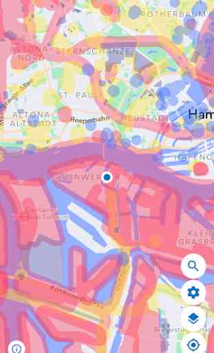
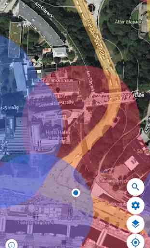
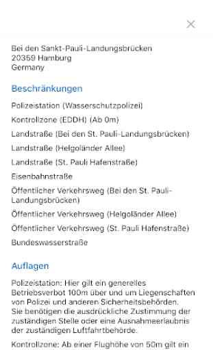
Do not feel like a long search before the drones start? With the free app of Map2Fly you experience as a drone pilot can always where you fly in seconds within Germany and what conditions you have observed. You just bestimmst your city and your planned altitude. The interactive map shows you on all relevant and applicable provisions of the current Regulation drones and ensures a safe flight preparation. You want only certain areas or airspaces see? Decide which rooms, facilities or obstacles you get displayed.
And the best part - you need to get started you can not log on and directly!
Why Map2Fly use?
ACCURACY: The integration of different data sources and official offers you Map2Fly the highest available in Germany accuracy.
TIME SAVINGS: spare the great deal of time by the simple display the current conditions at the selected location you.
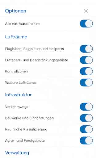
INDIVIDUAL: Let you display only the categories of air spaces or areas that you really need and select it from your own site or another arbitrary point. Decide is whether you prefer to see the normal map or satellite map.
Applicability: The app is ideal for both professional use and in the hobby and leisure sector.
Do you have any questions or comments? Visit us on www.flynex.de.
About 70,000 users Map2Fly use already, will you too. The community
And the best part - you need to get started you can not log on and directly!
Why Map2Fly use?
ACCURACY: The integration of different data sources and official offers you Map2Fly the highest available in Germany accuracy.
TIME SAVINGS: spare the great deal of time by the simple display the current conditions at the selected location you.
INDIVIDUAL: Let you display only the categories of air spaces or areas that you really need and select it from your own site or another arbitrary point. Decide is whether you prefer to see the normal map or satellite map.
Applicability: The app is ideal for both professional use and in the hobby and leisure sector.
Do you have any questions or comments? Visit us on www.flynex.de.
About 70,000 users Map2Fly use already, will you too. The community
Category : Tools
Related searches
Reviews (6)
Roh. N.
Apr 17, 2021
Atleast refine the specs and requirements based on drone category Ex under 250, until 2kg, above 2kg etc. They all have different regulations.so, provide us filter to choose our drone type and weight to refine our search
A. G. u.
Dec 19, 2019
Handy App and now supports English! 5/5
Far. Y.
Apr 2, 2021
Which color shows where I can fly my drone?
A. G. u.
Sep 4, 2018
If this works only for Germany, then it should be regional specific and not globally available in Play Store. It will help us, living somewhere else, not wast our time.
A. G. u.
Sep 9, 2018
Why not offer this in English
The app is only in German. No way to switch to English. Almost unusable for a person who does not speak German. There is even no way to copy the content from the app to a dictionary.