MapItFast
MapItFast has the following key functionality:
- Works offline in remote areas without a data connection
- One tap to map points, lines, polygons and photo features; even at the same time
- Use a long press to map points, lines, and polygons without a GPS
- Team based data collection and sharing in real-time
- Instant calculations for acreage and distance
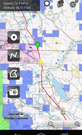
- Moving map display showing current location; multi-touch zoom
- Online and offline maps (Bing, Google, OSM) or upload your own custom basemaps and layers
- View maps in portrait or landscape position
- GPS stats window
- selectable for even more details
- GPS offset enabling logging to right or left of actual position
- Apply attributes from a personal or corporate data dictionary
- Pause and resume line and polygon features while mapping
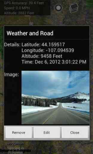
- Capture GPS coordinates for points and photos
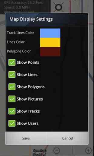
- Assign different colors and symbology for different lines and polygons
- Imperial and metric units
- Support for external Bluetooth GPS devices
- Enterprise level user controls and permissions
Note: This is the free version of MapItFast for personal use only. A commercial version of this product links the MapItFast mobile client with your online account. Cloud based data services offer the ability to:
- View all projects, user locations and contributions in real time online
- Collaborate with team members sharing locations/contributions over multiple devices
- Create, modify and managing multiple projects
- Add shapefiles from other sources as a map overlay (include symbology and labeling)
- Upload custom basemaps from other sources such as MOBAC and ArcGIS for offline use
- Create, edit, delete and share objects online
- Search, copy, move objects among projects
- Add custom data dictionaries to speed and standardize attribution
- Export to KMZ, SHP (shapefile) or GPX format for use in other GIS software
- Add attributes and generate printable PDF reports using customized electronic forms
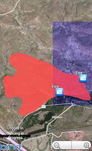
- Assign roles and permission based controls for projects and dataMapItFast is appropriate for all spatially based activities including inspections and surveys, agriculture mapping, wildfire and disaster response, utility work, crop scouting, mobile asset tracking, wildlife management, oil and gas fieldwork, forestry, rangeland monitoring, trail mapping, weed and pest projects, and even outdoor recreational activities such as hiking, biking, horseback riding, geocaching, and hunting.
Learn how to simplify and speed GIS data collection for the entire organization. Download the brochure at: www.agterra.com/mapitfast
View a promotional video at: http://www.youtube.com/watch?v=MuBlpssJo-w
Category : Maps & Navigation
Reviews (15)
I used it for one day and decided to uninstall it I'm not going to use it
Still evaluating
Love it
App is awesome for hunting and scouting. Shows me where my spots are and allows me to pin a picture of the spot as well.
Very useful app, simple and easy to use! Great app!
Awesome and easy to use
Customer service at AgTerra is top-notch. Previous concerns about cost were directly addressed. Educational pricing was offered to me as I am a graduate student. MapItFast is an excellent app that is user-friendly and easy to navigate. The best and simplest mobile mapping app I have found. Data were easily uploaded and quickly displayed with descriptions, coordinates, and any associated photos available at a click.
Map it Fast used in conjunction with Strider Forms have made our business 40 to 50% more efficient. My company works in the oil & gas industry and this software is a big reason why we are so successful!
The staff at AgTerra are great folks to work with and very helpful.
Don't download, or go ahead and see???? What another piece of crap. :( :( :(
Geared towards business use only, the free version is practically useless.
now I can measure my hikes, bike rides, etc., locate pics mark spots on my phone. way easier than a lot of gps handhelds.
This will be great for placing trails on a map when trail scouting
It's a great app for doing anything outdoors.
Takes a while to load and laggish graphics