MapVue
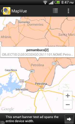
This app can load and display one or more ESRI Shapefiles with Google Maps as the base map. The overlay colors are randomly assigned by the app, but the user can bring up the layer properties to adjust the colors, opacity, and text labels. Only point or text features are clickable; however, users can enable text labelling for linear and polygon features. Once tapped, a snippet balloon will be displayed
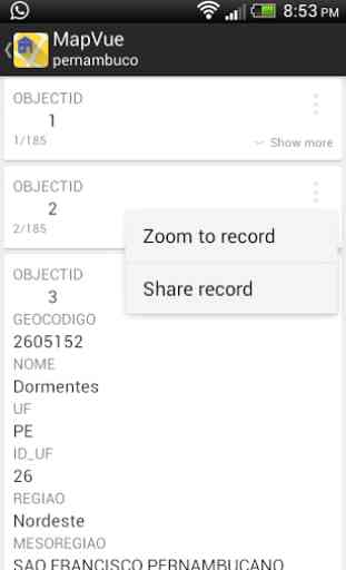
- a further tap will display the data attributes of the feature.
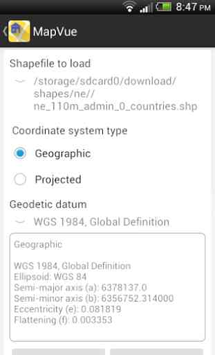
Only a limited set of source coordinate system types is available for this version, namely Geographic, and common projections like UTM, State Plane, Cassini-Soldner, Mercator, Transverse Mercator, with a choice of geodetic datums including WGS84. Unfortunately, user defined projection parameters are not available yet. Prj files are currently not used too.
The app will automatically remember the Shapefiles and layer properties without the user having to explicitly save the settings.
There are tons of ways the app can be improved but those are for later versions.
Have fun.
- a further tap will display the data attributes of the feature.
Only a limited set of source coordinate system types is available for this version, namely Geographic, and common projections like UTM, State Plane, Cassini-Soldner, Mercator, Transverse Mercator, with a choice of geodetic datums including WGS84. Unfortunately, user defined projection parameters are not available yet. Prj files are currently not used too.
The app will automatically remember the Shapefiles and layer properties without the user having to explicitly save the settings.
There are tons of ways the app can be improved but those are for later versions.
Have fun.
Category : Tools
Related searches
Reviews (4)
Ang.
Dec 23, 2020
Doesn't locate shape file properly even though the same shapefile is good on PC QGIS and other GIS software, if i try to view shapefile properties in shapefile the app just crashes.
Kei. M.
Oct 16, 2019
App works great, a little sluggish with large data, but faster than the others. I'll give 5 stars if I can purchase to remove ads 👍
Nik. K.
Dec 23, 2017
Crashes while loading large sph
Just a bit of delay in load shapes, but it is good to show the layers on map. The app name match with the app experience. Ps: I will try with bigger layers.