MX Mariner - Marine Charts
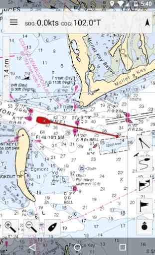
Offline raster marine charts are are available for the US, New Zealand, Brazil, and UK.
US, New Zealand and Brazil chart regions are free to download and update.
UK chart regions are available for the United Kingdom, Ireland and Channel Islands as in-app purchases. Each UK chart region in-app purchase gives you 1 year of free chart updates. UK chart regions in MX Mariner are "derived in part from material obtained from the UK Hydrographic Office".
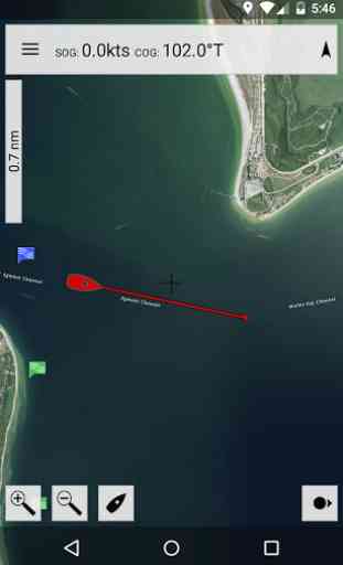
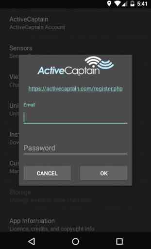
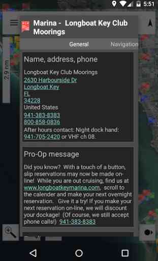
Features:Offline raster marine chartsOnline satellite and road mapsGPS NavigationActiveCaptain interactive cruising guidebook https://activecaptain.com/Waypoints
- create, edit, navigateTracks
- record, editRoutes
- create, edit, navigateGPX import / exportConfigurable units of measure and the World Magnetic Model
Please see https://mxmariner.com/#/manual for details.
Category : Travel & Local
Reviews (26)
Florida Biscayne Bay and Hawks Channel. For some reason it uses the lowest resolution chart. To see markers, depths and contours it's necessary to zoom in so close that you are looking at about 1 square mile to see anything. However offshore you see plenty of detail. This doesn't happen with other programs so I've resorted to using OpenCpn to see anything. What's the problem?
I used to really be impressed by this app several years ago. Being in Canada I had to convert my charts into a format this app uses. There used to be a tool off the mxmariner website that let you do that. The tool has disappeared. In previous version you could also assign where chart files could be stored. Latest version won't let you pick. As each new version comes out I have less and less user functions. Used to really recommend this app. Can't now. I now use open CPN (free)
Excellent and simple nav program. All NOAA charts downloadable free. Very hard to beat IMO. Also, users of this app should know that it can be loaded on a Chromebook. Even though Chromebooks do not support GPS, one can use MX Mariner to perform all functions of the app with exception of reatltime moving map. This allows download of charts so planning and other offline activities can be accomplished using the FREE chartsets available from NOAA.
Developer feedback good. Emailed about low resolution raster charts and had quick reply to explain uk charts are currently limited to a low 175dpi. New charts with better resolution are under development. In the meantime I use satellite on wifi to plan trips and build routes then will use raster chart offline on passage for clarity and to save data.
Very disappointed with the UK charts presentation, as described by another poster, very blurry display, so I don't use the app any more. Used to be ok in my old small phone years ago. No response to two detailed emails to developer. Very poor support. Such a shame, it used ro be great.
I've had the app for several years and it worked great. Now for some reason it won't display the depths on the maps. Also I am not able to Create a Route. Help - something has changed. I reloaded my Region2 chart but that didn't solve this problem.
Nice app. Very accurate. I have used this app for years in Tampa Bay Florida and the only issues I have is 1. Upon zooming in close,map gets blurry. And #2 Is that even know I'm told I can download on other devices, for some reason I am incapable of doing so. with all that said I highly recommend this app for trustworthy navigation
Extraordinarily useful app. I have a chartplotter on my boat but I always have this app running at the same time. It allows me to have one chart zoomed out while the other is zoomed in for details. As a backup it is invaluable.
Works good, but no option to display waypoint names on map like a traditional chartplotter. At lower zoom levels, chart gets fuzzy. No option to lock north up, touching display results in a rotation. Ill try it again later maybe we can get these features. Thanks.
very good app i use it all the time on a tugboat and on my boat at night. I had a little problem one time and emailed the administration and was actually called by a real person. That is important knowing they are there to help. Turns out the problem was on my end. I did a restart on my phone and it was all good. 5 1/2 stars!!
Once you understand the UI the app works fairly well. Have used it for about 2000 miles on the East Coast and icw. I use it in parallel with my Garmin chartplotter. It's great for doing day routing and the big picture.
I like this simple navigation app.Its easy to use on my tablet and compliments hard charts and navionics.I especially like the quick bearing and distance to function.I wouldn't advise using it tho as only tool..raster charts don't have all the detail.
I used to use this app years ago to great effect, but something is broken now on my Moto G5 plus with the zoom level, whatever zoom I'm at it shows the wrong scale chart. Unfortunately this renders the app generally unusable. If anyone knows a fix for this I'd be happy to hear it.
Guess it's been abandoned. No longer loads on my Galaxy S10... Really looking forward to using it today... and I guess it doesn't want to come out of hibernation after a long winter...
Great app, I have used it for almost 10 years. Only thing I would like to change is the contours and rocks offshore.
Unusable, charts display at such low resolution no detail can be seen. Moto G5Splus Android 8. 1.0 If no fix produced want money back. Had app 2 years ago and worked fine on the same phone
This was once very good but now when I zoom in the charts are blurry. What has gone wrong? Please fix and issue an update.
region 17 downloaded to galaxy s10e. useless in bays no depth information at more than 0.2 miles scale. not like examples in ad. worthless for me. waste of money and storage. disappointed.
I have MX Mariner on my tablet. It says it no longer supports for my tablet I paid for this so what am I supposed to do. Is there a way I can download the free nz charts outside of the app. Betterstill support older tablets
For the money this app can't be beaten. Has go me out of a tight spot more than once. Key for me is the regular chart updates.
zoom has been reduced to a blur never used to be like this to zoom onto sandbanks and wreck positions now has very very limited functionality had to pay again for my charts waste of money used to be a good app
Need to be able to zoom in closer without it going all blurry. I payed for this it should work great but it doesn't
Downloaded paid and purchased Uk Sw charts- despite owning the chart only certain areas are usable.others are so blurry can’t do anything with them-I have written several emails asking for advice but no reply😡frustrating
I bought charts and now it's saying they're unavailable. It was a while ago but I bought charts, where are my charts?
Doesn't let me log in. Changed password and tried several times to get logged in but keeps telling me that I have to log in.
I used to use this app a lot when I was operating instruction and charter. It was an excellent resource. Now I can no longer see depths, the ICW will not display in region 6 the charts it overlays covers up the information on the other chart I need for rout planning with no way to select which chart is on which layer. Totally unusable outside of looking pretty and pretending to show you useful information. I had hoped to use this app again as I used to while ferrying a vessel, useless and sad.