Nautical Charts — OsmAnd
Usage Instructions: it is highly recommended to download nautical basemap in order to see the maps regardless of detailed map presence. Nautical charts are provided as a map and a special style, to switch style in OsmAnd please use the menu item 'Configure Map' on the map screen.
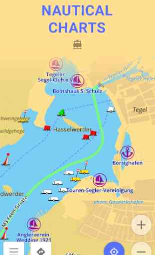
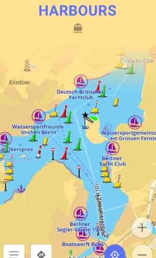
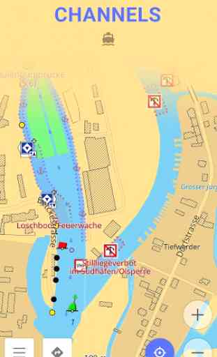
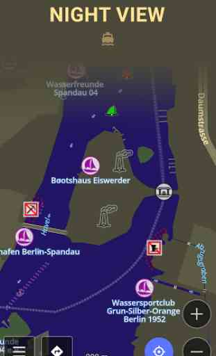
Nautical Chart is a detailed graphical representation of oceans, seas, coastal areas and rivers.
Nautical Charts are made for people who drive any kind of vehicle on water: from professional sailors to people who rented a boat to make a tour over city canals. The charts can contain various information like sailing routes, navigation lights, dangerous areas, areas where it's allowed or not allowed to sail or dock, etc.
All the professional sailors are obliged to have official nautical charts on their ships. These charts are published by authorized agencies and cost quite some money. Agencies are investing a lot in keeping the charts up to date. They release updates for the charts on regular basis, but because of the fact that reviewing the information and processing the updates takes quite some time the nautical charts are never completely up-to-date.
Nautical charts of OsmAnd are based on the data from OpenSeaMap project. The idea of the project is to build the detailed map by people how actually use it. Every user of the map can contribute by adding changes to it making it more detailed and more accurate.
While OpenSeaMap charts at the moment cannot compete with official nautical charts, they can be used by recreational sailors for orientation or route planning.
Category : Travel & Local
Reviews (29)
says it installs after download but it doesn't. No icon come up as with as with any other app. zero stars
cant find after install and no open app button
Very helpful and informative
Plugin to what? How do I open and use this??
Thanks you so much
Wouldn't use it for primary nautical navigation but it's a useful emergency tool. Needs to show depths closer to shore though
Need an alternative download method for the depth contours because in app fails and doesn't resume. Coverage is basic so please contribute!
Nautical details are terrible using the Gulf of Mexico map. No navigation markers, depths are wildly inaccurate compared to NOAA charts. Don't waste your time.
I would give this plugin five stars could I only find out the units it uses and change them...Other than that ir is ideal for preplanning and giving a perfecr overview. Also works quite well for offshore fishing as it lets me work with my own private hotspots chart. Thanks guys...Now where do I find that nautical chart units setting?
Cannot enable nautical navigation android 7
Have used this app around the world. Takes a bit to learn but very useful.
This is a PLUGIN. It won't show an "open" button because you have to activate it from the actual Osmand app. After you do it works just as promised and shown on pictures. Don't give bad ratings just because you don't bother reading the short introduction sentence or the instructions provided by Osmand. And if those are too much of an effort, please don't leave solid ground either ;)
Would not display nautical charts. Acted only like Google Maps, except showed a correct map and route, to a specific address, but said it was in another city. Could not bring up any charts of local waterways.
I have been using this app for more than a year and it was really good and easy but now im having a hard time using it, because they made a lot of changes in the new update...
I finally managed to get it downloaded but can't enable it. When I click on the plugin in main app I only have the "GET" option. I click that and it says installed! - on galaxy s6 edge
I hope the plugin will slowly include additional information like water depth. Great work. It looks clear.
Very, very helpful. It is so exciting to have one like this in your android phone
But the chart is buggy,, specially in singapore, the land becomes missing when zooming in,
It does not even install properly
I done downloaded the apps but i cnt find where the apps is....
I Hope it gets better by the day.
You are wasting your time. It doesn't download.
Fails to load in main app.
Really good and practical.
Needs work, but very promising, thumbs up!
Downloaded. Shows install, but can't find the app not showing up anywhere other than installed apps. No way to open the app. Hhmmmm. suspect it's me, but then again?
Great app, did a good job navigating the Venice Lagoon
Looks like it has everything we need....on our way to the river!
Great app but like all the others very little coverage of British Isles without buying them for £30 plus which is a huge commitment without seeing a viable sample. However, already used the GPS function between Ardrossan in Scotland and Belfast Lough in Norn Ireland. Worked perfect but no chart datum.