Nautical navigator
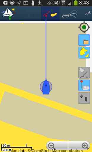
Nautical navigator is a free offline Android app providing you sea maps from openstreetmap and sea markers from openseamap projects.
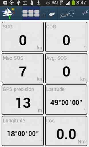
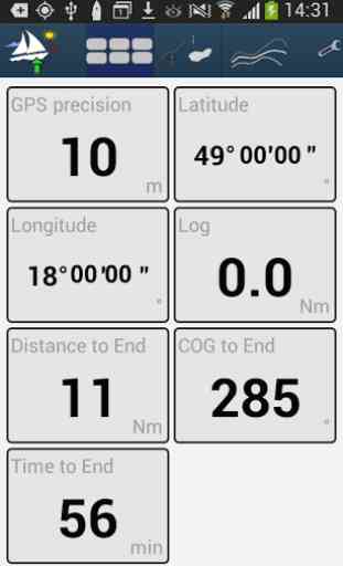
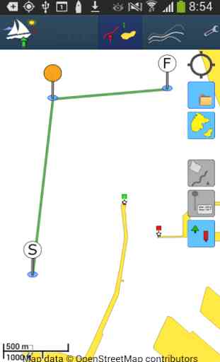
Main features:• Land contour with sea charts colors• Sea marks • Planning route via waypoints with detailed information about distance and time to next waypoint• Tracking your positions• Anchorage alarm• Importing and exporting sea planner (tracks + waypoints) to GPX file• Managing multiple tracks and waypoints in simple menu• Polar chart of your boat• Estimation of time to next waypoint depend on the polar charts• Overview of SOG, COG, Log etc.• Many other small features
Main features:• Land contour with sea charts colors• Sea marks • Planning route via waypoints with detailed information about distance and time to next waypoint• Tracking your positions• Anchorage alarm• Importing and exporting sea planner (tracks + waypoints) to GPX file• Managing multiple tracks and waypoints in simple menu• Polar chart of your boat• Estimation of time to next waypoint depend on the polar charts• Overview of SOG, COG, Log etc.• Many other small features
Category : Travel & Local
Related searches
Too confusing! To see seamarks you have to download maps, but there are dozens and the file names give no indication which is for which area.