
Nevada Pony Express OHV Trails
Make the most of your visit to Nevada’s Pony Express territory with this amazing app!
Created specifically for Nevada’s Pony Express territory, the Nevada Pony Express OHV app will provide you with information about the areas and communities along Nevada’s portion of the “Loneliest Highway” (Highway 50) tracking the historical route Pony Express riders took over a hundred years ago.
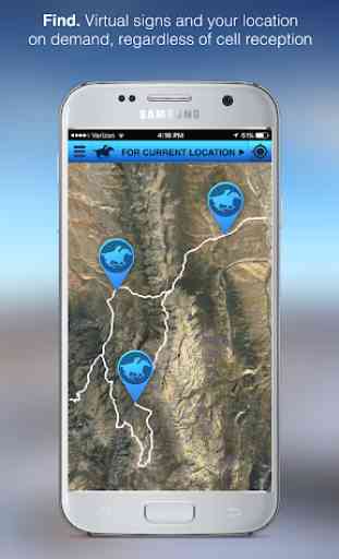
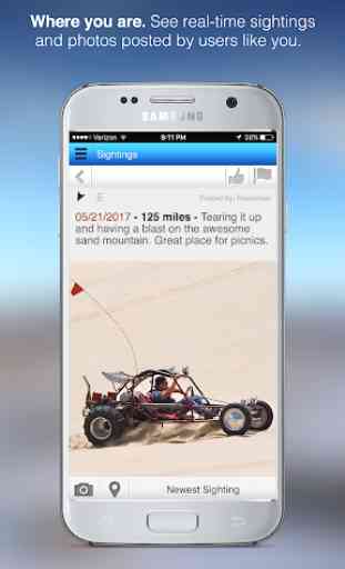
Follow in their footsteps or take one of the specially chosen off highway trails (with more to come!) curated by those in the know from each community. Track your progress within the app, with our (offline-enabled) maps that work with and without cell coverage. Document your adventure—create waypoints, post sightings and photos, and see others’ photos and sightings.
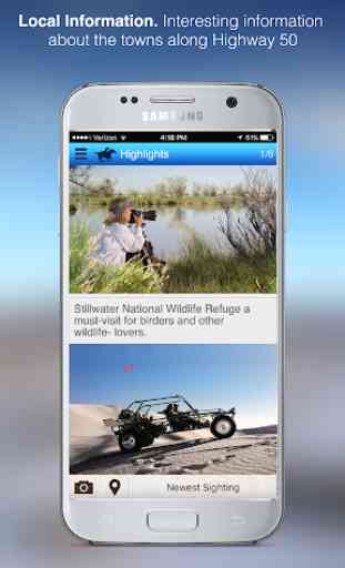
Learn about the towns (big and small) of Fallon, Dayton, Middlegate, Cold Springs, Austin, Eureka, and Ely. Learn about their present day events and attractions, as well as their history, and highlights.
Take your Highway 50—Pony Express visit, and off-road adventures to a new level with this helpful and informative new app!
Created specifically for Nevada’s Pony Express territory, the Nevada Pony Express OHV app will provide you with information about the areas and communities along Nevada’s portion of the “Loneliest Highway” (Highway 50) tracking the historical route Pony Express riders took over a hundred years ago.
Follow in their footsteps or take one of the specially chosen off highway trails (with more to come!) curated by those in the know from each community. Track your progress within the app, with our (offline-enabled) maps that work with and without cell coverage. Document your adventure—create waypoints, post sightings and photos, and see others’ photos and sightings.
Learn about the towns (big and small) of Fallon, Dayton, Middlegate, Cold Springs, Austin, Eureka, and Ely. Learn about their present day events and attractions, as well as their history, and highlights.
Take your Highway 50—Pony Express visit, and off-road adventures to a new level with this helpful and informative new app!
Category : Travel & Local
Related searches