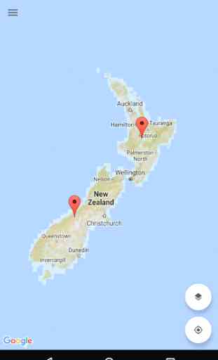
New Zealand (NZ) Topo Map
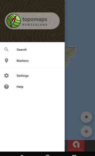
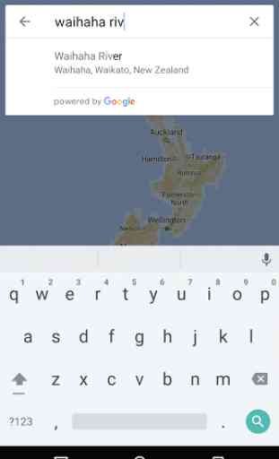
• View topographic tiles and satellite imagery• Viewed tiles cached automatically (for offline availability)• Add unlimited map markers• Show your location and distance to markers• Import / export GPS Exchange Format (GPX) waypoints from Google Drive• Search for places of interest• Navigate with Google Maps interactions (pinch zoom, scroll, drop marker, drag marker etc)• Battery conscious (for those that can't recharge every day)• Fully functional for free! (no lite or pro versions required)
New Zealand (NZ) Topo Map is intended for outdoor enthusiasts who want to mark locations visited or create markers to visit. It does not provide track information, record while walking, show speed etc. It's designed to be lightweight, intuitive, responsive, battery conscious and totally free. Perfect for casual day trips to serious bush excursions.
Developed by an adventurous Kiwi for adventurous Kiwis!
Topographic Map Tiles
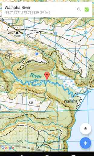
The Topo50 map series provides topographic mapping for the New Zealand mainland and Chatham Islands at 1:50,000 scale.
At a scale of 1:50,000, Topo50 maps show geographic features in detail. They are useful for a wide range of activities such as local navigation by vehicle or on foot, locality area planning and study of the environment. Used by a wide variety of groups, Topo50 is the official topographic map series used by New Zealand emergency services.
To produce our Topo50 maps of the New Zealand mainland we use:
• The New Zealand Geodetic Datum 2000 (NZGD2000) – the coordinates of longitude and latitude
• The New Zealand Transverse Mercator 2000 (NZTM2000) projection – this is what enables the curved mathematical surface approximating the Earth to be represented on a flat sheet of paper.
To produce our Topo50 maps of the Chatham Islands we use the Chatham Islands Transverse Mercator 2000 (CITM2000) projection.
Topo50 map tiles sourced from the LINZ Data Service http://data.linz.govt.nz/ and licensed by LINZ for re-use under the Creative Commons Attribution 3.0 New Zealand licence.
Satellite Imagery
LINZ has been working towards getting New Zealand’s most current publicly-owned aerial imagery – covering 95% of the country.
Aerial imagery is captured from airborne sensors and cameras. It provides an accurate photographic representation of the earth’s surface and the features on it. It can be used to visualise landscape, or to understand how an area has evolved over time.
Sourced from the LINZ Data Service and licensed for re-use under the Creative Commons Attribution 3.0 New Zealand licence (http://www.linz.govt.nz/data/licensing-and-using-data/attributing-aerial-imagery-data)
Category : Maps & Navigation
Reviews (27)
Am so sick of the Marker 'feature' popping up! I hardly ever want to use it but often just scrolling around a map causes it to come up, every second touch sometimes!!! So annoying!!! Apart form that it's a great app, accurate maps, easy to use.
Love this app. Used it this past weekend while out on a overnight section of a bush craft course with local Tramping Club. Awesome to know where you are all the time. Just learnt I am import a gpx file to show on map. Great feature. Thanks for a great app. Cheers Bryan 😙
Excellent App. It works just like it says on the box, and once maps are downloaded they work perfectly offline, which is essential for me in the forest. One issue is, that like many apps, it wont work on a circular smart watch. This is because the controls are at the corners, and vanish off screen on circular screens. How about a smart watch version Mason, with controls out of the corners ?
Brilliant App. Intuitive and easy to use. I have just walked off-grid for 6 days and never needed to open my paper map. Battery usage is efficient. With judicious use of the GPS I managed on a single charge of my Android device. Not bloated with 'features' I don't need or want. The software is reliable with no glitches or crashes.. unlike some of the other offerings I've tried. It's free but I'd happily pay for this App.
VG UI. Love the Rd names ex openmap & the aerials. Newbee questions: 1. How do i download(cache) all of nz at a scale readable on smartph. 2.When i zoom out (after caching) topo is fuzzy.. not sure what i am doing wrong?
Excellent map and free. Property boundaries show when zooming but disappear when basemap loads. Would be willing to donate if there was an option to overlay property boundaries. Other suggestions - A compas/gps tab to point you directly at waypoints.
Love the app, and I'd even be interested in a paid, ads-free version. An addition I would love to see would be for markers to support grid references, as sometimes its a little difficult to spot grid numbers on the map.
Great topo map app. Have used this for years on multiple trips. It would be great to be able to toggle between the Topo50 and Topo250 when more zoomed out though!
Excellent App. Does everything you need it to. I use it for backcountry tramps and long trail runs. Caching feature is perfect for use out of service.
The ocean has been removed from the satellite imagery, it was really helpful for finding fishing spots, now I'll have to use a different app, this one was really good
Great idea for a free topo map but it does not allow you to download large areas and generally the app was useless for me beacuse of the download speed. Super slow.
Excellent. Like to know how big the north or south island file is?. One brilliant feature for me is searching with nztm coordinates from old Garmin, not only finds it ,but gives me paper map coordinates which makes this the best convertor I have used. I like to have paper as well
Mason, awsome app used by pretty much every outdoorsy person I know. Any way I can get in contact with you? I've got an idea. Names Manu - Health and Safety Manager at Outward Bound.
Great free app does exactly what I expect and doesn't try to be too fancy. Would love a non-free version that isn't ad supported.
Great way to see NZ topo maps on your mobile. Auto caching of viewed tiles is excellent too, as it allows map viewing when out of coverage
This is the one you want! Outstanding. It's free but has all the features of the paid apps.
Looking good ! I really like the topomap and sat images.
A lovely wee app and very useful.
Does its job well 👍
Great app that's free and does what it needs to, quick response from developer who added in options for downloading tiles. Very useful!
Fantastic app! SD card support a great addition.
Great free app thank you!
Active developer. Requested download tiles for an area recently and here it is. Thank you very much!!
Works well, maps caches for offline use. Maps appear to be largely up-to-date (many Topo map apps appear to have map data which frankly is hopelessly out of date). Would like though an option to pay to remove ads.
Awesome app bro any chance we could export/share points as kml file or something we could upload to gps, google maps,earth etc.
I want to be able to delete Markers from list.
Good app however I am new to it and yet to fully test it out tramping. At the moment I am having difficulty using the Snapshot function. The screen indicates that the tile has downloaded and says "see notifications for details" But there is nothing in notifications. I'm using a Samsung Galaxy A02 phone. Any advice would be welcome