
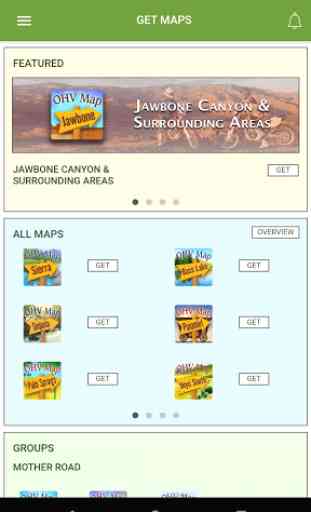
OHV Trail Map California
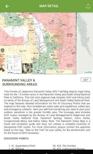
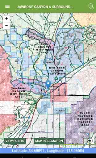
View the map in several zoom levels and navigate to popular destinations throughout California. The map covers 85 million acres of world-class OHV recreation lands from the sand dunes in the desert to the forests in the mountains, from the Colorado River to the Pacific Ocean. Depicted on the map are thousands of miles of legal, designated OHV roads and trails, as well as OHV Open Areas, wilderness areas, State Parks, military bases, and other public and private lands.
The map features backcountry motor vehicle routes designated by the BLM, USFS, NPS and other land management agencies.
Featured within the app are:
√ Street level background layer can be turned on or off
√ Zoom and scroll across the map
√ Find your location (iPhones and cellular iPads only)
√ Track your movement across the map (iPhones and cellular iPads only)
√ Find and navigate to hundreds of back country destinations and points of interests
√ Obtain emergency and other contacts
√ Find local services such as fuel, lodging and food
√ Learn area OHV rules, regulations, and safety tips
√ Legend of symbols on the map
Category : Travel & Local
Reviews (13)
What's the point of making these maps if we can't even view them in any detail beyond "zoomed all the way out." Showing my gps position on a map that covers a more than 100 mile radius is pointless. How did you expect us to follow these trails if we can't view them in any detail?
This would be useful if you could zoom in enough to read the map. Also, the app only works in the portrait orientation and won't switch to landscape which is limiting and annoying.
On the surface it seems great but then i realized i cant zoom in on maps for high detail. Im guessing its more designed for Iphone not really android.
Absolutely useless app. You can download maps but you can't zoom in enough to see anything.
As others have said. It does not allow you to zoom in far enough. Not usable for riding offroad trails.
Works great as an offline copy of the map for Inyo North. Can't ask for more.
Simple easy to use and navigate and updated info on riding trails in and near jawbone CYN
Need ability to zoom more with precise location
I would give it a zero star cause tje maps won't load up at all.
Useless app can't download any maps
Can't get the maps to load
Will not load maps on Note 9.
It's a good start. Few features i'd like to see before I seriously consider using over Avenza PDF Maps: 1. Compass. Currently, the location is only shown by a blue dot. Avenza provides the direction I am facing. 2. Zoom in! I need to be able to zoom in more 3. It would be great if it could display multiple maps at the same time 4. Downloading multiple maps/mapsets at once 5. General bugfixes. It doesn't seem like anyone tests the android version. If I enable my location blue dot, it doesn't allow me to view any other portion of the map.