PhoneMaps
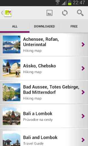
PhoneMaps application offers downloadable detailed hiking and cycling maps in the scale of 1:25 000 for the whole of Europe, including Austria, Switzerland, Germany, Benelux, Czech Republic, Slovakia, Poland, Alpine region of France, Provence and Corsica, Slovenia, northern half of Italy, Great Britain, Norway, Finland, Sweden, Denmark, Japan, Taiwan, New Zealand. The range of maps is constantly expanded with new areas. It also offers the users zoomable maps and guides to major tourist towns, regions, states or hiking guides of famous Bergverlag Rother series.
You no longer have to hunt for maps and guides in bookshops or e-shops and search for the right one. You can download all you need from PhoneMaps application at significantly lower prices than hard copies. You can naturally download the same maps free of charge onto multiple devices with the same operating system and have a free update of map data. Why don't you take advantage of a free trial of all this on a range of products?
The application offers product downloads but can also work off-line without connection to the Internet. So the application and its products can be downloaded, i.e. via a wi-fi and then be used, including the zoomable maps, completely off-line without having to pay for an internet connection and data transfer.
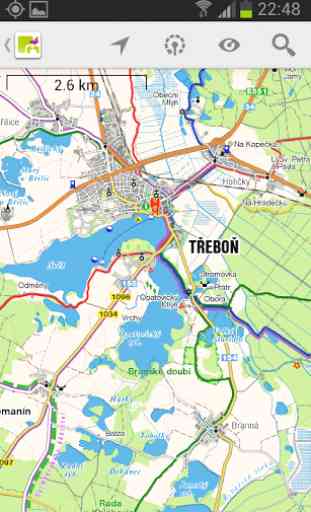
The maps used in the application and the individual products are zoomable with variable scale. The map content is modified for each scale for easy reading. The vast majority of products shows tourist points of interest above the maps consisting of a text description and images. Tourist points of interest represent the most important tourist attractions in detail. All the maps used in the application and its individual products can display the current GPS position of the user. The maps are fully searchable for individual sites with full text. The user can create his own photos and points of interest within the application, which will always be shown above the map. The application can also record and subsequently display the walk-through the route of the user, you can insert your GPX route or send your route to your friends.
PHONEMAPS APPLICATION WILL BECOME YOUR FAITHFUL ASSISTANT ON YOUR TRIPS AND HOLIDAYS.
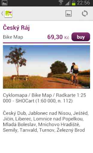
HIKING AND BIKING MAPSMaps with variable scale
- Maps of all of Austria, Switzerland, Germany, Benelux, Czech Republic, Slovakia, Poland, Alpine region of France, Provence and Corsica, Slovenia, northern half of Italy, Great Britain, Norway, Finland, Sweden, Denmark and other attractive parts of Europe. The range of titles expand every month.
- Detailed topographic map content includes hiking and cycling trails.
- Display of tourist attractions with descriptions of photos directly on the map.
ROAD MAPS AND CITY PLANSYou will no longer get lost!
- Road maps and city plans of the most important tourist regions and cities.
- Contents and the key to signs suitable for easy planning and orientation .
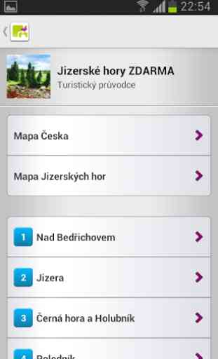
BERGVERLAG ROTHER HIKING GUIDESHikes through beautiful landscape
- The most attractive areas throughout Europe.
- General information about the areas.
- Detailed tourist map of the whole region in the zoomable scale of 1:25 000
- Recommended trips with a description of the trail and tourist attractions and with a dynamic map and elevation profile.
- Display of tourist attractions with descriptions and photos directly on the map.
EDITION OF TRAVEL GUIDES For your travel around different countries, regions and cities
- Guide to different countries, islands, cities and other attractive tourist areas.
- General and practical information for tourists.
- Many theme oriented maps for tourists describing the area.
- Display of tourist attractions with descriptions and photos directly on the map.
Category : Travel & Local
Reviews (12)
Incredibile!!! This app offers all maps for free and is showing your position in real time. I tried several apps and this one is excellent for hiking.
works great , in the sense that it's helped me find hiking trails all over Europe and the Balkans, amazingly even in Kosovo. No issues at all with the latest updates.
I bought a book where it's said that I have maps for free. However, I have to pay again in the app. Also, I tried to register but it's just giving me a error.
I paid yearly subscription but unable to register.
Best free offline maps for region of Alps i found so far
The best world map I have ever used
Satisfied!
I bought a map from shocart.cz which led me to this app. Although the app is full of maps I would like to scan the code on the map which entitles me to free access. I can't find this option on the app.
It works just fine on my HTC Sensation. Very useful and handy application, great alternative to printed guides.
App works as advertised. The new version is a huge improvement.
The app crashed 5 times during first 5 minutes. Uninstalled.
For manual reliable route mapping, this is probably the best free app I've come across. Hike is hike, bike is bike, no extra fuss of complicated hiking and biking levels. Just two things: 1. Would be great if the "Via points" could be adjusted by drag and drop. 2. Also, could you introduce a way to read externally created GPX files? Please...?