qtVlm Navigation and Routing
It includes an AIS module and an Instruments Module, that can retrieve data from various NMEA sources, or from internal GPS.
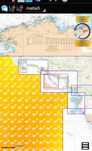
Rasters and mbtiles maps are added by simply putting them in the relevant qtVlm directory, or via the import/export module.
qtVlm can be used simultaneously in two modes:
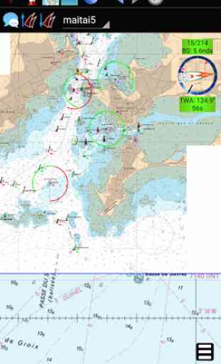
In real boat mode, qtVlm will show the boat's position and calculate the best course using Route and Weather Routing modules. Many options are available, like multi-routing to find the best departure date-time according to various parameters, or taking in account segments with engine, etc. qtVlm can acquire position and NMEA information via various sources (internal GPS, tcp, udp or gpsd), and can display many navigation instruments.
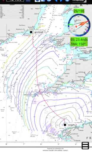
In virtual mode, once registered to one of the numerous races organized by Virtual Loup de Mer (VLM: http://v-l-m.org), qtVlm connects to VLM server to control the boat, to set the autopilot or to calculate the best course using route and routing modules, etc. Whether you are a real sailor or not, it's the best way to learn weather routing science and techniques.
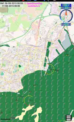
Geo-referenced marine maps (kap, geotif, geojpg, etc.) can be loaded, and weather faxes can be displayed over the map. qtVlm can also display maps from Tiles Servers, or from mbtiles files.
Several grib files can be loaded at the same time, in order to be able to route using various parameters (winds, currents and waves for instance).
Route and Weather Routing modules, navigation instruments, anchor alarm, mbtiles and AIS modules are available only with the full version, available through in-app purchase. The full version also add automatic rasters quilting.
qtVlm is also available freely on PCs (windows, mac/os, linux), including all modules and fonctions.
Don't leave shore with out it!
Category : Weather
Reviews (12)
I would like to apologise to Philippe for the trouble he went to to find a bug that did not exist. probably something within Android that was serendipitously fixed with an Android update. all is well with Qtvlm and I discovered just how meticulous and professional Philippe is in supporting his product.
Professional app. Features are impressive and required for true offshore sailing, racing/cruising.
Great tool for navigation! I´m using and sharing with others.
great app with lots of features and ease of use.
not intuitive, hard to use, uninstalled already
One of the Top 3 weather routing apps I have used.
Great app for weather routing!
Getting much better keep up the great job
Best app for offshore weather routine by far
It would be ideal if you could lock barriers on screen
Unusable, unless you pay a high price. But sorry, I want a quality proof before !
colours are unreadable I have seen a demo at meteo consult Henk Huisman. That demo was very good I remember. But in the test version I cannot test the routing. Navionics has a real working testperiod and that reveals the strenght of their app. Although its missing the tidal and wheather correction as in QTVLM. But the colours do not change if I try to adjust them. A pitty because I know what this program can do. And that's amazing.