RF Terrain Profiles
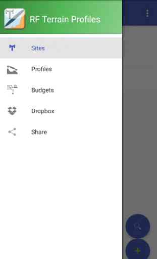
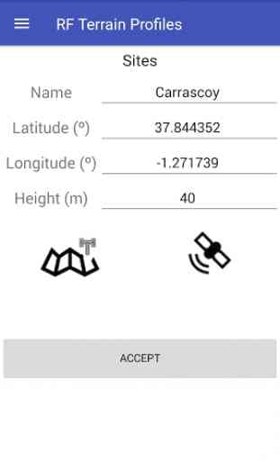
- SITES DATABASE. You can create a single or multiple sites over terrain. Also, you can import KML files generated in Google Earth or export KML files to be used in Google Earth.
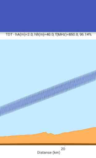
- REPRESENTATION of terrain profiles and First Fresnel Zone between two geographical points. You can see immediately if the First Fresnel Zone is obstructed or not by the terrain and the percentage of the First Fresnel Zone clear of any obstructions is automatically calculated. Also, the Free Space Path Loss is calculated.
- OPTIMIZATION of the antenna heights in the sites for a given First Fresnel Zone clearance. Very useful to find automaticaly the antenna height needed to satisfy some visibility conditions.
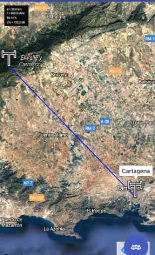
- ORIENTATION of the antennas in azimuth (relative to the North) and elevation (relative to the horizon) between two geographical points. Useful for quickly orientating the antennas situated at the sites.
- LINK BUDGET. The Link budget calculations can be done to determine the maximum allowed path loss, taking into account the equipment configuration elements and parameters (transmitting power, cable loss, antenna gains, sensitivity, etc.)
- DROPBOX. You can store results (sites database, profiles etc) and share them (if you want) instantly with your RF Terrain Profiles user group.
- DIGITAL TERRAIN MODELS.You can calculate profiles, without an additional cost, using data provided by GOOGLE with 500 points per profile from a Digital Terrain Model (DTM) with a resolution of 90x90m.
Category : Tools
Reviews (12)
problemas creando profile server busy again new version 6 android update ok
Not working after Marshmallow update
just need a pc version
Easy to use. Would like to see option for entering data in feet as well as meters. Great teaching aid.
Nothing works on this app, I've tried everything but does nothing more than take your money! Dont try it.
This is a very useful tool for communications planners. Nice that you can export/import kml with Google earth. Thanks radiato!
Thank,i think my conection poor and bad,i has try again in wifi conection and working
Took a little bit to figure it out, but now when I have used it for a few days I am loving it. The UI could be polished.
This is Frequency managers dream!!!
This app is very useful, but could use a few minor tweaks. The biggest improvement I could see is giving the user the ability to scale the profile to a useful range (i.e. 5-50km).
Hope to see DMS input support in the future and edit functions in the profile tab. But the base functions so far are really great! Hope to see some more updates... Thanks!
the result of the path profile is not generated by the system. it returm a blank white scree. sometimes it return " server busy" message. it occur even after i reinstall