RIDGID® Trax
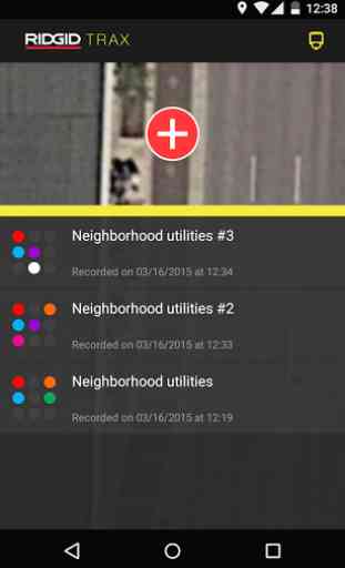
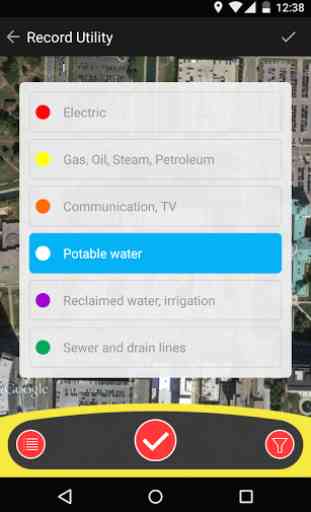
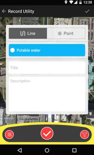
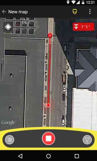
RIDGID® Trax enables basic underground utility mapping in real time. Connect an Android device wirelessly with Bluetooth to a RIDGID SR-24 Utility Locator and RIDGID® Trax will display GPS position and depth of the target utility. A user can identify the type of utility (water, gas, electric, etc.) and display multiple utilities on the same map. A finished map can be saved and viewed inside the app or exported to a *.KML file for use with popular GIS programs.
Category : Tools
Related searches
Reviews (3)
Jes. G.
May 10, 2019
cannot add a new line . glitch in the app. please fix
Kev. N.
Jul 26, 2018
I'm looking for a natural gas line in a county and it won't go North to where the property is that I put a bid on. Places there use propane tanks and I dont want that. Can you tell me how to do it? Thanks
May 2, 2020 installed and re-installed this app 4 times on my up to date 2018 Samsung S7 edge because I just bought the SR24. App crashes before opening! Come on guys get thing fixed already!