RTKGPS+
Android RTKLIB frontend.
source code can by downloaded on https://github.com/eltorio/RtkGps
Heavily based on RtkGps from Alexey Illarionov, this is a fork of his work. He allows explicitly to modify and redistribute his work only with the distribution his copyright. You'll find the original license in the "About/Legacy Info" screen. Thanks to all contributors to respect this original license clause.
Since there is no new version I reworked the code for adding some features I need:
1
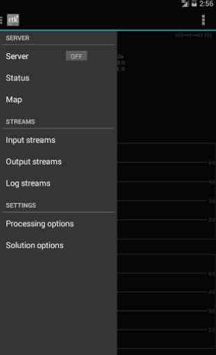
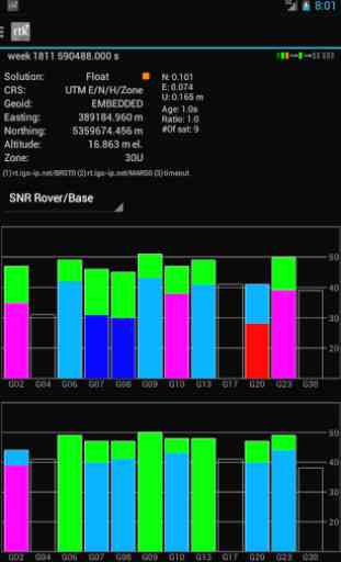
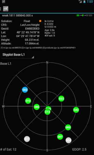
- show the altitude in the status view. for activating this you need to choose Height:Geodetic in the "Solution Options" view2
- send mock locations to other applications. for activating this you need to check in the "Solution Options" view Output GPS mock locations, but this is only working if you have allowed "mock locations" in the developer settings (in Android setting). today (in 1.0alpha13) the mock locations are not usable in the Google map API.3
- automatically upload log file or solution file to your Dropbox account4
- can generate a gpx file of the track5
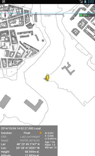
- can display the result in ECEF, WGS84 Lat/Lon, NAD83, Lambert 93 (RGF93) or UTM (with auto zoning) coordinate system5b
- use any Proj4 projection6
- can display ellipsoidal height or geodetic altitude (different geoid models can be use see: https://github.com/eltorio/RtkGps for how to install a geoid model)7
- use any RTKLIB compliant GNSS with raw output connected via USB (ACM/PL2303/FTDI), Bluetooth, TCPIP or NTRIP8
- can display some maps coming from IGN Geoportail (cadastral parcels, satellite, roads), OpenStreetMap Mapnik, Bing (satellite, roads).9
- can download and use IGS ultra-rapid ephemeris
This software is a port of RTKLIB 2.4.2p9 developed by Tomoki Takasu (http://www.rtklib.com), if you do not know what this application is; this application is probably not what you are looking for!This application can compute precise GPS positions using RTKLIB algorithms (RTK or PPP) but for this you need a supported -external
- GPS with raw carrier phase output.This is not a "standard" GPS like those embedded into your phone or your car, the cheapest one you can find is something like uBlox LEA-6T .THERE IS NO WAY to use the GPS found in Samsung Galaxy(s) nor any phone I seen.
But there is a special test mode witch use the internal GPS for testing only, obviously none of the precision algorithm found in RTKLIB can be use.
Category : Productivity
Reviews (22)
Very good App. I do wish as if this app have the manual hehe.
Experience excellence with navigation
Nice apps but is there any way to know baseline length information on these apps?
what is the gps accuracy of this apps?
Is there any tutorial or guide about how to connect and configure?
What precision can we expect?
Now on use
A good app for relevant users. Would've been great if someone took it further as rtklib is actively moving fast
Perfect for our needs but really would like out of you could choose an input file elsewhere on the device or on the network. Having the file only in the home directory is very limiting. But great job with the port.
I'm having a problem while using the RTKGPS+. When I try to write the "Base Station Position" when configuring the INPUT BASE on Input Streams, I can't write any NEGATIVE coordinate as the coordinates of my city are: 3.45000, -76.53333 (deg) 3°27′00″N 76°32′00″W (dms) How can I fix that problem? or can you fix it and upgrade the alpha version?
Please help with sources of open VRS from India...
This port of RTKLib is a real great job!
Due gps leap second,rtk+ cannot receive gps signal from rtcm 3. Please repair it
What shall I do?
Love it
Any plan to tested on xiaomi mi 8 with dual frequency L1 L5?
Thank
Hi I am using a u-blox LEA6T GPS that is paired with my Android device. Is there any setting required to connect Android device with the GPS because this application doesn't seem to connect to my GPS. Thanks in advance
Thank you for this amazing FREE app.
I like the output option and link dropbox. It make this software more useful
Can you port this to communicate via arduino board APM 2.6 using the OTG cable?
I use TERSUS receiver, there is no format data for this receiver, but in RTKLIB v2.4.3 there is a TERSUS format, can you add the TERSUS format to this apps? thanks a lot!