RTN Friend
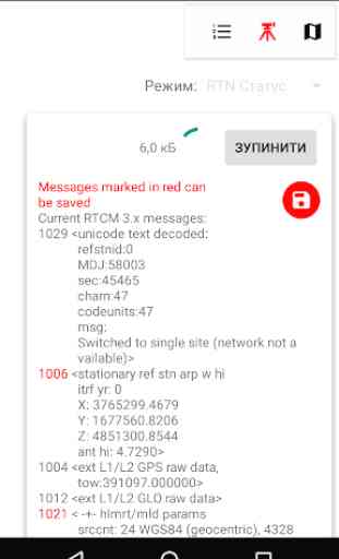
RTK Network status. Before traveling to a new job site it is good to know how RTK network works there ahead of time. Will the network be able to generate network solutions (VRS, MAC) or not ?, or it will just “close” rover to the nearest base, what will be the distance to the nearest base in this case ?. This app will get answers to both questions now, while you are at home. With RTN Friend you will know for sure whether you can count on your network at your destination or not. This app shows on a map Leica Spider (MAC type) master and auxiliary stations depending where you are! so you will see if you can trust MAC network geometry.
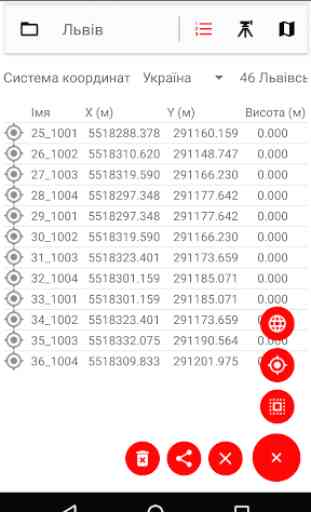
Coordinate conversions between different coordinate systems, use coordinate systems transmitted by RTK network in 1021-1023-1025 messages. RTCM coordinate system can be downloaded and used for survey or coordinate transformation. User defined coordinate systems are available now.
Point import from txt, csv files or manual key in.
Point export as standard google share button
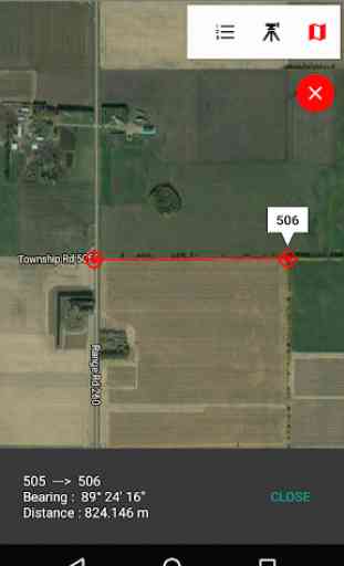
Survey with Leica GGxx, Emlid Reach RS, South S660/S660P and other receivers. Stake out points and lines
Please note this app will run free for 3 month after that it will be available at the subscription rate: 13 $ for 3 month. Please also note that you will not be able to access your projects without subscription after 3 month! please account for that.
Manuals are available at https://rtnfriend.wordpress.com/
Please send your questions to [email protected]
Coordinate conversions between different coordinate systems, use coordinate systems transmitted by RTK network in 1021-1023-1025 messages. RTCM coordinate system can be downloaded and used for survey or coordinate transformation. User defined coordinate systems are available now.
Point import from txt, csv files or manual key in.
Point export as standard google share button
Survey with Leica GGxx, Emlid Reach RS, South S660/S660P and other receivers. Stake out points and lines
Please note this app will run free for 3 month after that it will be available at the subscription rate: 13 $ for 3 month. Please also note that you will not be able to access your projects without subscription after 3 month! please account for that.
Manuals are available at https://rtnfriend.wordpress.com/
Please send your questions to [email protected]
Category : Maps & Navigation
Related searches