
Search and Rescue Application
- and time-tagged photo and video evidence that can be transmitted back to the server for map-based display. SARApp works over land, in the air, and on water – wherever GPS signals can be received. If a phone lacks 3G/4G connectivity, the app will store track and evidence data until it is within range to transmit.
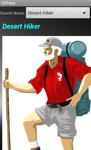
SARApp Client Features: •Register for a search electronically •Receive description and photo of search subject from Search Manager •Start and Stop tracking •View summary of distance traveled and time spent searching •Display active track, other searchers’ tracks, and assigned sector on the map page •Take photo or video evidence and transmit to the SARApp Server with geo
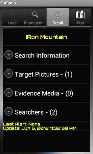
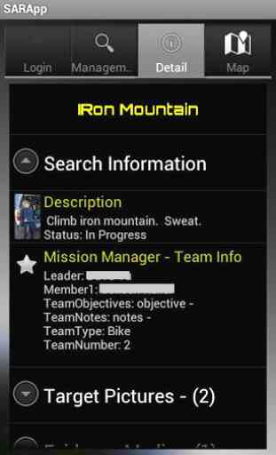
- and time-tags •View field-collected evidence provided by the Search Manager •Receive assignments and alerts from the Search Manager •Control position update rate to conserve battery usage SARApp Server Features •Browser-based interface can be accessed from any location/device with internet connectivity •Create and modify searches •Map-based tools for building search sectors •Collect volunteers and make assignments to search sectors •Push sector assignments to SARApp users •Monitor search activities in real time on the map interface •Display and view evidence collected from the field on the map •Make sector re-assignments on the fly •View estimated Probability of Detection achieved for each sector and for the entire search •Activity Log showing registrations, assignments, and evidence received •Push messages to searchers in the field In addition to field search activities, SARApp can be used as a general real-time situational awareness or field intelligence collection tool. For example, personnel responsible for documenting storm damage, fire boundaries, road closures, the extent of flooding, or evacuated houses could use SARApp to send photos and video back to the Server for viewing on a map.
Category : Productivity
Reviews (5)
My community has authorized volunteer team members to use this app as a team on assignments. It is very useful but must access a server for greater functionality. Nevertheless, it is quite a nice app. Also, I found it would not install on my Android 2.3 smartphone with 16 MB of free on-board memory even though the app is less than 2 MB in size. Surprise!
This is a must have for all professional search and rescue teams, and RCCs
Just started testing this app for the team. It took some help from the Metron Support but David quickly took my email and called responded quickly. He called me and led me through the process of assigning sectors and coordinating teams. This could be very useful if the team decides to download the app and their smartphones and go through an initial setup process. Too bad there are members who do not have a smart phone.
Darjeeling sikkim wader Trekking tour intestate. Sanbkphu Zurich sikkim
This app does everything we need from search and rescue to area search for evidence. This is an excellent resource that has gotten our team a lot of attention from our higher ups!